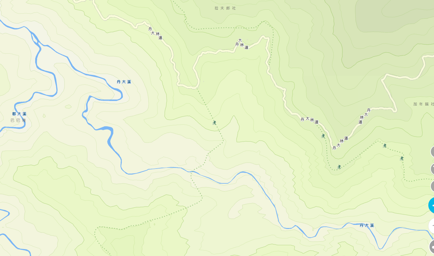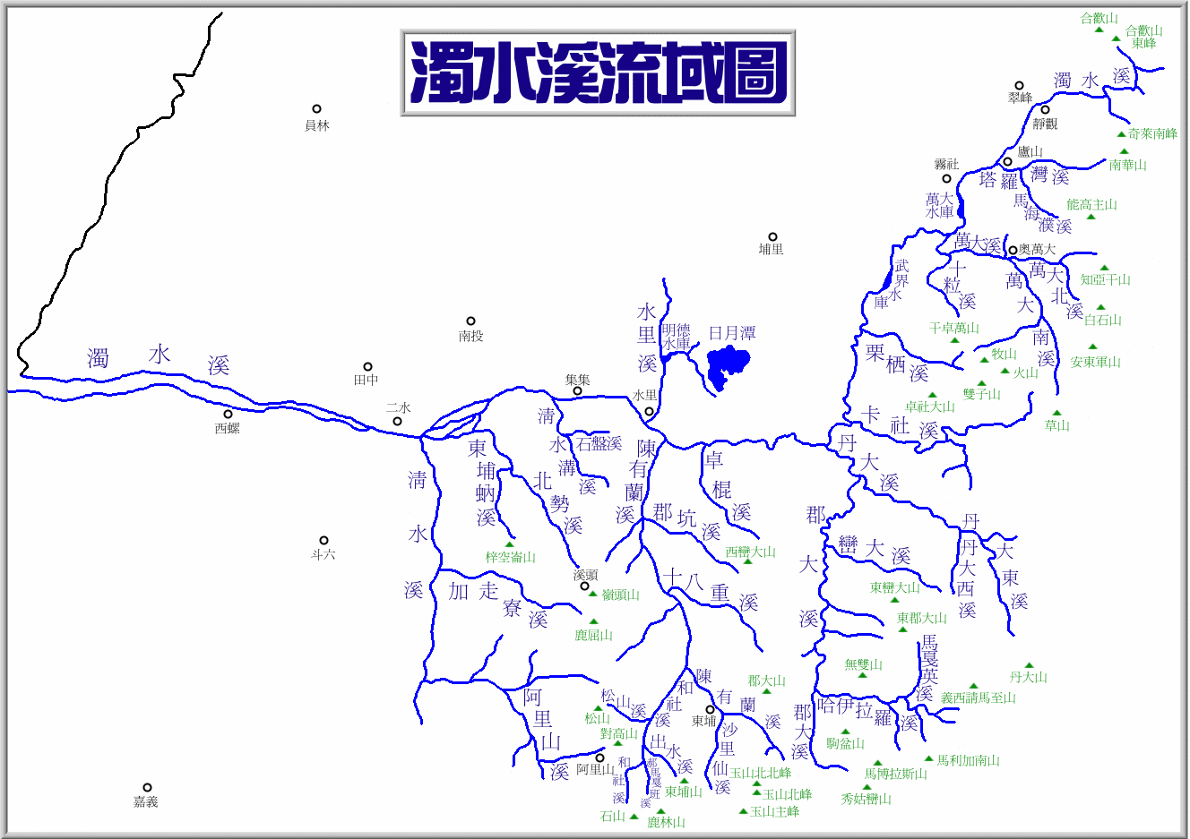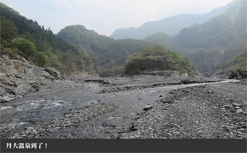
Danda stream 丹大溪
Hot springs survey
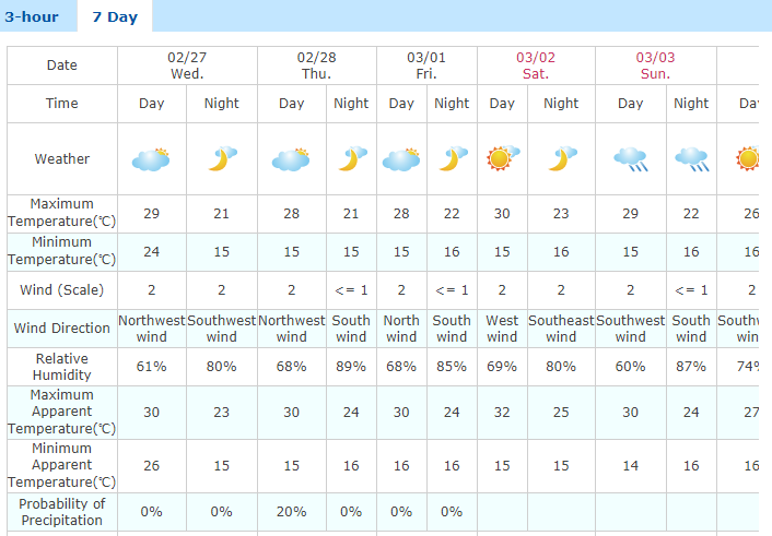
2/27 - 3/2, 2019
https://www.facebook.com/events/372732886838005/
Philip Diller | 0938-824-801 | philip.diller@gmail.com |
Leigh Hardy | 0930-144-643 | hardyleigh@yahoo.co.uk |
Wolfgang Schechinger | 0987-936-784 | hubahopp@gmx.de |
Ronan Counihan | 090-5419-884 | ronancounihan@hotmail.com |
Judy Wan-Ling Chen |
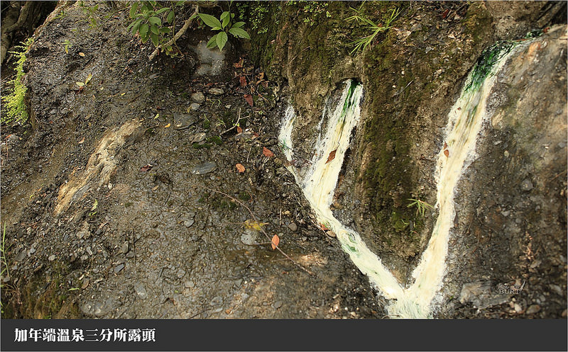
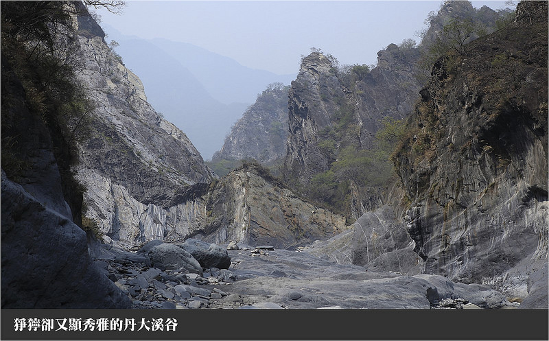
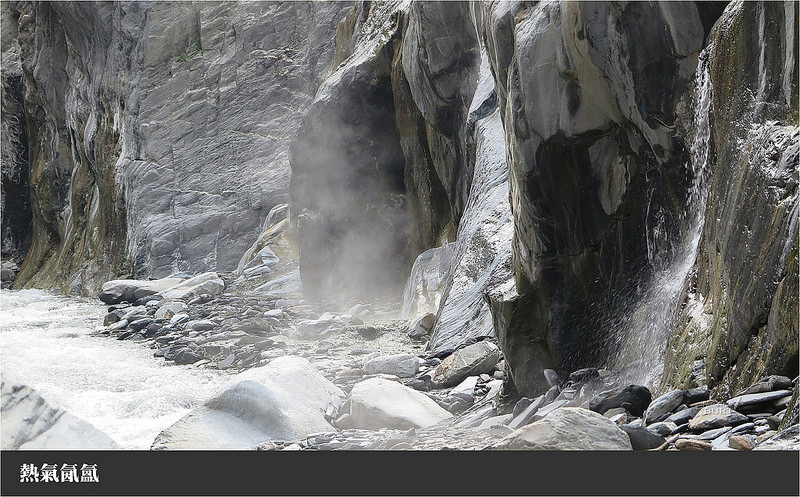
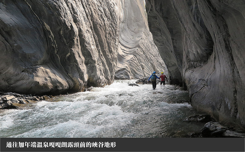
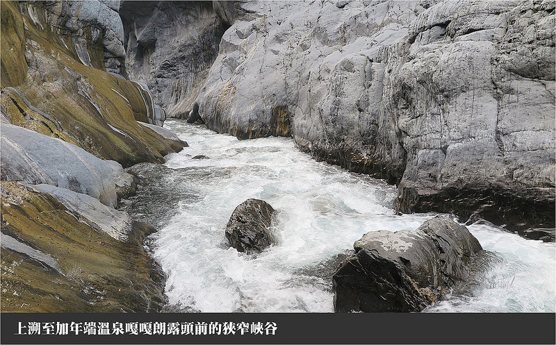
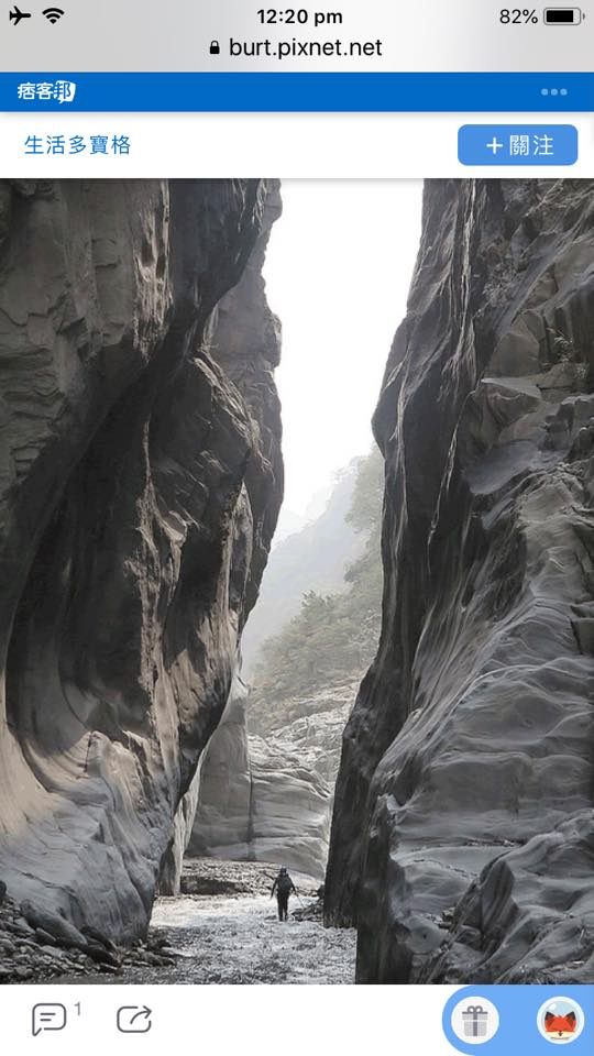
The Jia Nian Hot Springs 加年端 溫泉 in Nantou 南投 is a section of wild hot springs over 300 metres long on the Danda river 丹大溪 culminating with Danda hot springs 丹大溫泉 further upstream.
We will drive to the end of highway 16 in Nantou county 南投縣 Xinyi district 信義鄉 late in the evening of 2/27 where we’ll camp for the night for an early start the next morning. The next day we’ll hike along the flat, silty river bed of the Danda river 丹大溪 to the main series of springs (17k/4hr). If possible we’ll push through the first slot canyon to establish a basecamp. The next day, we’ll continue further upstream with light packs exploring other outcrops and attempting to reach Danda hot springs then return to the basecamp. We’ll hike back to the car on the last day and visit Double Dragon Waterfalls if time permits.
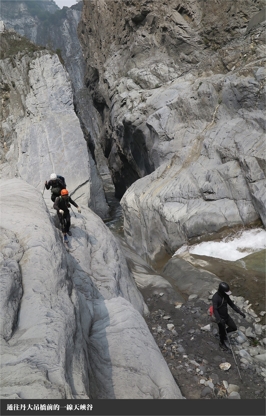
Reaching these spring outcrops requires passing through 3 slot canyons. The 3rd of which has a waterfall and is probably the most difficult. Each team member must be self-reliant, experienced and comfortable with challenging river tracing.
Train Type | Train Code | Origin-Dest | Departure Taipei | Arrival Taichung | Estimated Time | Fare |
Tze-Chiang Limited Express | 105 | Keelung→Pingtung | 07:00 | 09:16 | 2h 16m | $375 |
Tze-Chiang Limited Express | Cidu→Pingtung | 08:28 | 10:38 | 2h 10m | $375 |
Xindian MRT to 台16線 Nantou, Xinyi, 3 h 17 min (253 km) via 國道3號
https://goo.gl/maps/frqar7i4DUo
23.7871310,121.0108899
https://www.google.com/maps/place/23°47'13.7"N+121°00'39.2"E/@23.787131,121.0087012,17z
This is where we will park our car.
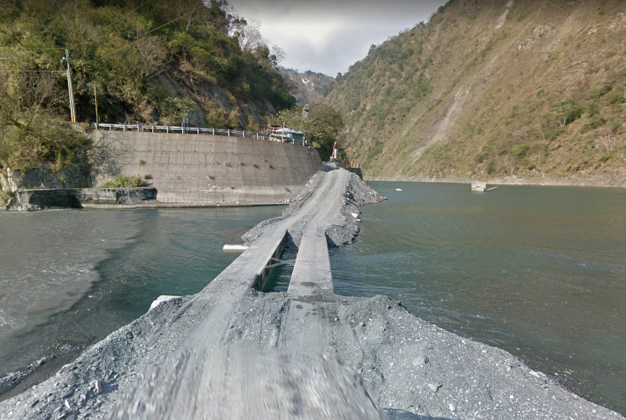
Control point on Danda Road 丹大林道
https://goo.gl/maps/bMZXeKs2nw72
Can this point be passed by hikers without vehicles? 23.77867,121.0450837
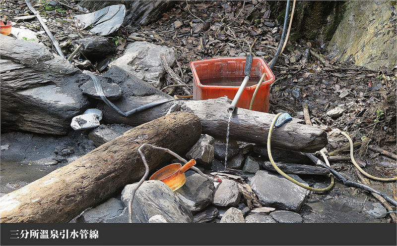
This is well before Sanfensuo (3/10ths station) 三分所 on the Danda road 丹大林道.
We plan to hike up the Danda river bed instead of on the Danda road.
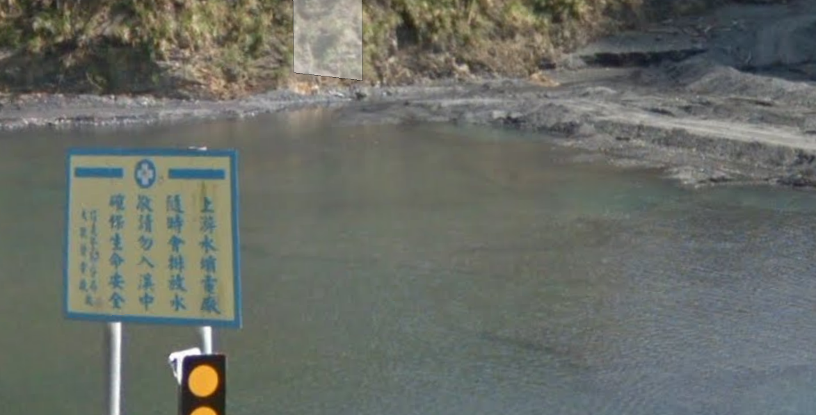
Where are the dams being released which this sign is warning about, and on which river? Tracking of river gauges and careful survey of imagery suggests that any dams are on the Zhuoshui River 濁水溪 rather than on the Danda river 丹大溪 tributary.
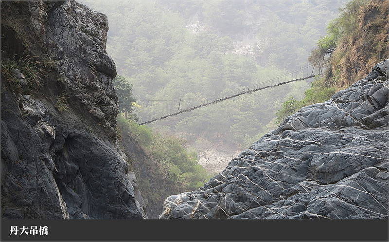
關門國家步道系統 or 關門古道 - This trail comes off of the Danda road and goes directly down to Danda hot springs. The trail does not seem to be listed on the Forestry website anymore.
The additional distance to Danda hot springs 丹大溫泉 is considerable. The path would either be in the river where the topology is extreme, or along Danda road 丹大林道 to Liufensuo 六分所 then following the Luantan mountain trail 巒潭山登山步道 (or Guanmen trail 關門古道 on some maps) down to the hot springs. This route is 30 km, climbing 3313 m and dropping 2645 m to arrive at Danda hot springs 丹大溫泉 which is at 1142 m. The CGS site suggests that Danda hot springs has been reduced by siltification recently.
http://210.69.81.175/SpringFront/DetailResearchData?springsId=65
加年端 ,位於南投縣信義鄉雙龍村,定位點於(X): 256305 (Y): 2627094 海拔625m。溫泉出露於溪左岩壁。露頭影像照片為林義貴提供。自92年冬季後迄今尚無更新資料。[出露岩性]中新世,廬山層,硬頁岩、板岩、千枚岩(二十五萬分之一臺灣區域地質圖數值檔,臺灣)[微兆區範圍]溫泉露頭位於丹大溪流域
http://210.69.81.175/SpringFront/DetailResearchData?springsId=66
丹大 ,位於南投縣信義鄉雙龍村,定位點於(X): 265274 (Y): 2623103 海拔1142m。 丹大溫泉原本的泉溫相當高,有幾近沸滾的溫泉池,部分也冒著氣泡,不過,近年因溪谷砂石堆積影響,露頭已減少,泉溫也混雜溪水而降低。[出露岩性]始新世,畢祿山層(五十萬分之一臺灣區域地質圖數值檔,臺灣2000)[微兆區範圍]位於丹大溪上源卡阿郎溪與丹大東溪交匯處,溫泉露頭綿延約100公尺以上,以卡阿郎溪為主要分布區域。
March 2015 expeditions - 10 outcrops 露頭, 3 slots
Numerous outcrops discovered along the remote slots of the middle Danda river. 100’s of amazing photos. We later discussed our trip with River Chen.
Following on River’s trip above, this group traced upstream from Heliuping.
http://www.twem.idv.tw/2/a67.htm
Informative, Interesting map, the team applied for their permit in Taipei, which was demanded at the control point at Sanfensuo 三分所 on the Danda road. This post suggests that tracing up the river to reach Danda hot springs 丹大溫泉 is about impossible. Even taking the trail down from the road seems like it was tough.
丹大林道與七彩湖探勘心得-201804
https://blog.xuite.net/wild.fun/blog/576801467-%E4%B8%B9%E5%A4%A7%E6%9E%97%E9%81%93%E8%88%87%E4%B8%83%E5%BD%A9%E6%B9%96%E6%8E%A2%E5%8B%98%E5%BF%83%E5%BE%97-201804
2018, informative, jeep trip, impressive photography of Danda road
Sunrise: 6:18
Sunset: 17:55
Shuili 水利
https://www.cwb.gov.tw/V7e/observe/real/C0I36.htm
Refer to the CWB Aowanda model for a conservative forecast similar to Danda
Atmospheric temperatures drops an average of 6.5 degrees C per kilometer of altitude.
http://fmcc.wra04.gov.tw/v2/default.aspx
http://www.metoc.navy.mil/jtwc/jtwc.html
http://www.metoc.navy.mil/jtwc/products/wp0219prog.txt
WDPN31 PGTW 230300
“The ECMWF, AFUM, and GFS trackers are indicating a sharper turn westward as the system rapidly dissipates.”
WDPN31 PGTW 242100
“Westerlies over the system as well as dry, cold air entrainment associated with a northeast surge event will serve to rapidly weaken the system leading to dissipation by Tau 96.“
The Danda river 丹大溪 is one of the 12 major tributaries of the Zhuoshui River 濁水溪, Taiwan’s longest river at 186 km.
Annual average rainfall in the Zhuoshui River watershed 濁水溪流域 is 2,200 mm, which decreases moving from the mountains downstream toward the coast. 70% to 85% of the rain falls during the rainy season from May to October, and the flow of the Zhuoshui river gradually decreases from October into the dry season in winter.
River height 水位 (m) | Rain 雨量 (millimeters) last hour/day | Xinyi 信義 rain forecast (avg POP next 24h) | |||||
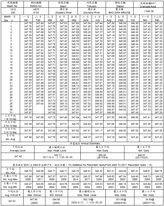
Date/Time | Yufeng bridge 玉峰大橋 1510H063 | Baoshi bridge 寶石橋 1510H075 | Shuili 水利/水里 C0I36 | Qingyun 青雲 C1I150 | Kanaituowan 卡奈托灣 C1I140 | Danda 丹大 C1I050 | |
02/12 18:40 | 263.4 m | 0 mm | 0 % | ||||
02/13 09:10 | 263.5 m | 0 mm | 0 % | ||||
02/15 08:30 | 263.5 | 0 | 20 % | ||||
02/17 20:40 | 263.4 | 0 | 10 % | ||||
02/18 20:50 | 263.55 m | 346.39 m | 0 mm | 0 mm | 0 mm | 0 mm | 30 % |
02/19 16:20 | 263.54 | 346.38 | 0 | 10 % | |||
02/20 11:10 | 263.55 | 346.37 | 0 | 0 | 0 | 0 | 10 % |
02/21 16:20 | 263.95 | 346.39 | 0 | 0 | 0 | 0 | 20 % |
02/23 11:00 | 265.26 | 346.39 | 0 | 0 | 0 | 0 | 70 % |
02/24 19:40 | 265.27 | 346.4 | 0.5 mm | 1 mm | 1.5 mm | 2 mm | 50 % |
02/24 13:20 | 264.04 m | 346.4 m | 0.5 / 2.5 | 1 / 3.5 | 0 / 2.5 | 1 / 5.5 | 30 % |
02/24 18:30 | 264.04 | 346.42 | 0.5 / 5.5 | 0.5/9.5 | 0 / 7.5 | 1 / 10.5 | 20 % |
02/24 22:00 | 264.04 | 346.43 | 0 / 6.0 | 0 / 9.5 | 0.5 / 10.0 | 0 / 12.5 | 20 % |
02/24 23:50 | 264.04 | 346.43 | 0 / 6.0 | 0 / 9.5 | 0 / 10.0 | 0 / 12.5 | 20 % |
02/25 07:40 | 264.04 | 346.44 | 0 (6 hrs) | 0 (12 h) | 0 (6 hrs) | 0 (6 h) | 10 % |
02/25 09:30 | 264.04 | 346.43 | 0 (12 h) | 0.5/7.5 | 0 (12 h) | 0 (6 h) | 10 % |
02/25 14:30 | 264.02 | 346.39 | 0 / 3.5 | 0 / 6.5 | 0 / 6 | 0 / 6.5 | 0 % |
02/25 19:40 | 264.04 | 346.4 | 0 / 0.5 | 0 / 0.5 | 0 / 2.5 | 0 / 1.5 | 0 % |
02/26 06:30 | 264.04 | 346.39 | 0 | 0 / 0.5 | 0 | 0 | 0 % |
02/26 12:20 | 264.02 | 346.37 | 0 | 0 | 0 | 0 | 0 % |
02/26 18:30 | 264.04 | 346.37 | 0 | 0 | 0 | 0 | 0 % |
02/26 23:10 | 264.04 | 346.38 | 0 | 0 | 0 | 0 | 0 % |
02/27 07:20 | 264.04 | 346.39 | 0 | 0 | 0 | 0 | 0 % |
02/27 16:10 | 264.82 | 346.38 | 0 | 0 | 0 | 0 | 10 % |
Data sources:
Hydrological information is collected by the WRA (Water Resources Administration under the MOEA), CWB (Central Weather Bureau, and TPC (Taiwan Power Corporation) but not consistently integrated.
http://fmcc.wra04.gov.tw/v2/default.aspx
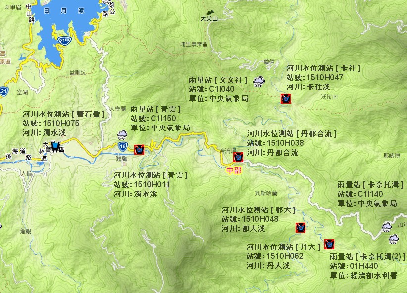
River Water level Baoshi bridge 寶石橋 and other nearby sites
Other river level stations
Rainfall measurement in the upstream Danda basin
Other rainfall stations
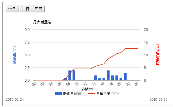
Danda 丹大 C1I050 station hourly and accumulated rain at 02/24 23:50
Weather Forecasts
Taiwan hydrology data
http://wise.wra.gov.tw/group/721201c1-34c8-4e40-bbfd-444895a7a1a5?organization=river-and-coast-division&organization=hydrology-division
-<RiverCode>
<BasinIdentifier>151000</BasinIdentifier>
<BasinName>濁水溪</BasinName>
<EnglishBasinName>Zhuoshui River</EnglishBasinName>
<EnglishSubsidiaryBasinName>Danda River</EnglishSubsidiaryBasinName>
<SubsidiaryBasinIdentifier>151070</SubsidiaryBasinIdentifier>
<SubsidiaryBasinName>丹大溪</SubsidiaryBasinName>
</RiverCode>
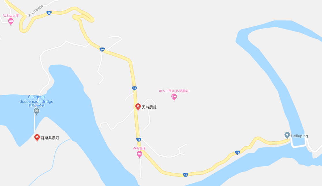
Drive from Taipei to Heliuping 合流坪 at the end of Highway 16. Leave Taipei at 8:30. Arrive at Heliuping around midnight. Stay at one of the commercial campsites near the end of the road or camp in the river bed.
3 h 23 min (257 km) via 國道3號
https://goo.gl/maps/dv3arNogVDM2
Camp 露營 in the river bed a beginning of hike or in a commercial campground at the end of road 16?
https://goo.gl/maps/Ft85zHdhc4n
Breakfast ?
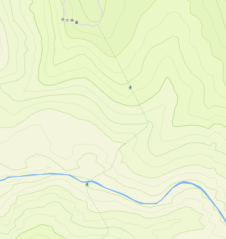
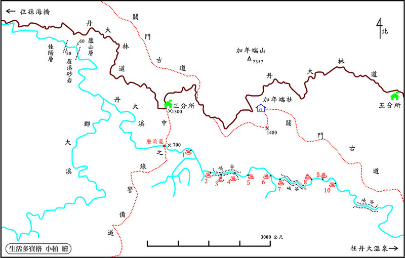
Our maps and data are based on river traces before typhoon Soudelor (August 8, 2015) which certainly impacted the Danda canyon. We will have roughly 4 hours of walking time on Day 1. It would be ambitious to reach the first outcrop recorded in the Spring of 2015 at about 12 km upstream from Heliuping 合流坪. We will pass the Junda stream 郡大溪 confluence to the south, and the path going up to Sanfensuo (3/10ths station) 三分所 on the Danda road 丹大林道 toward the north before arriving at the first Jianianrui 加年端 outcrop.
The 2015 Burt team took 2 hours to reach the Junda stream 郡大溪 confluence from Heliuping 合流坪.
This is one of the few exits from the canyon. The trail climbs up from the river to the 3/10ths check point in the Danda road. The trail climbs steeply 600 m over roughly 1500 m. Trip reports suggest that this trail was difficult to find in 2015, so should only be considered for emergency.
The 2015 Burt team arrived at the first (Sanfensuo 三分所) outcrop at 12:30, 4 hours out from Heliuping 合流坪.
We should aim to reach the 2nd outcrop just before the first slot canyon for our basecamp to allow us to maximize tracing time on day 2.
The Burt 2015 team got up through the first slots and camped at outcrop 5 where they spent three nights.
If the water levels are similar, all packs would get submerged passing through the first slot section.
River explained that the slots can only be passed at minimal water levels and that there are no records of any tracers succeeding since Burts trip. Outcrops 3 and 4 are in the first slot canyon, then outcrops 5 and 6 are in the open area between the first and second slots, where we hope to pitch our basecamp.
Trace upstream toward Danda hot springs with light packs and full tracing gear exploring the many Jianianrui 加年端 outcrops along the way.
Hike back out to Heliuping 合流坪 > Optionally, drive to Double Dragon Waterfalls > Drive back to Taipei
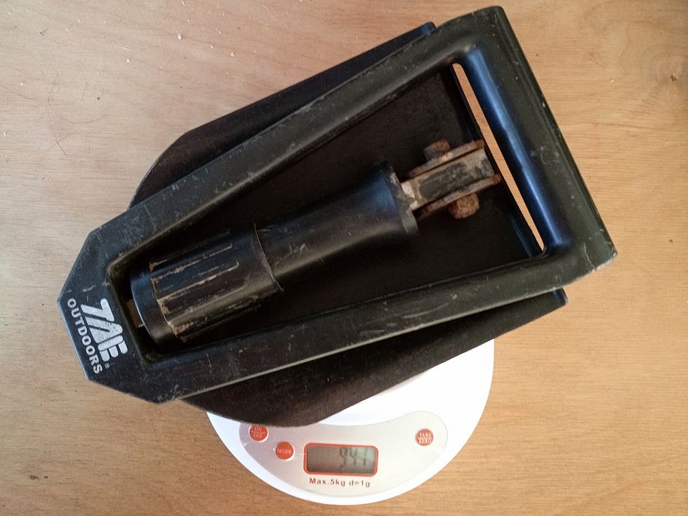
river shoes (must have), wet suit (optional), helmet (recommended), gloves (optional), dry bag (optional), walking stick (recommended), harness (recommended)
headlight, tent, sleeping bag, mattress
rain gear, hat, water
Personal
stove, cooking pots, ropes, med kit
(bring, may leave in car.)
100台北市中正區汀州路三段81號
02 2364 8567
Gear listing: http://bluepuffy1990.pixnet.net/blog/post/13754758
營業時間: 下午2點~晚上8點
Closed Tuesdays and Saturdays
電話:(02)2858-2353
營業時間:10:00~20:00 (星期日公休)
地址:台北市士林區文林路581號
http://www.dbk.url.tw/river.htm
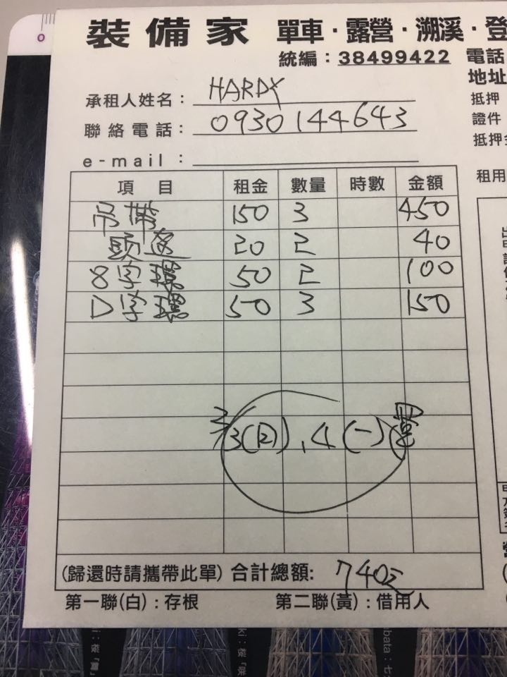
(for 2 days) harness: 150, helmet 20...
has more rope and technical gear than Eva (below)
服務專線 (9:00~20:00): 03-4814662、0916156616 (旭昇)、0981363970 (淑玉)、
信箱: goforwild@gmail.com FACEBOOK
http://www.goforwild.com.tw/rent.php
服務時間:14:00-22:00 每週二店休
聯絡人:史依凡 Eva
http://www.eva-sports.url.tw/product_cg79726.html
臺北市南昌路2段112號 1樓
TEL: (02)2368-4358 FAX: (02)2365-5860
背包 · 登山杖 · 睡袋 · 手錶. 品牌經銷點
Ting San Iou Mountain Equipment Co.,
TEL : 02-2311-0089
台北市中山區中山北路一段18.20.22號
您的入山申辦序案號108022000167,因禁止入山退件(說明:丹大林道道路損壞未修復尚未開放申請),敬請重新申辦。
如有申辦方面的問題,逕洽南投縣政府警察局(電話049-2234394),服務時段09:00-11:30及14:00-16:30(不含週休及例假日)。
?
A survey conducted by the Forestry bureau using trap cameras along Danda road 丹大林道at Sanfan station 三分所 and Lieufan station 六分所 station from Nov. 2012 to Oct. 2013 recorded 2870 photos of game in 41412 hours, including 5 herbivores - sambar deer, muntjac, serow, macaque, and boar; and 4 carnivores - marten, civet, weasel, and ferret badger. Occurrence was high for sambar deer and muntjac, but low for other game. The survey was used to put forward preservation policy for the area.
A 2004 survey along Danda road 丹大林道 conducted by Taiwan Normal University 台灣師範大學生物系 recorded 38 species of mammals, including 12 protected species:
Formosan black bear 臺灣黑熊 (tái wān hēi xióng) Ursus thibetanus formosanus,
Formosan clouded leopard 臺灣雲豹 (tái wān yún bào) Neofelis nebulosa brachyura, Formosan rock macaque 臺灣獼猴 (tái wān mí hóu) Macaca cyclopis,
Taiwan serow 臺灣野山羊 (tái wān yě shān yáng) Capricornis swinhoei,
Formosan Flying Fox 臺灣狐蝠 (tái wān hú fú) Pteropus dasymallus formosus,
Formosan Sambar Deer 臺灣水鹿 (tái wān shuǐ lù) Rusa unicolor swinhoei,
Yellow-throated marten 黃喉貂 (huáng hóu diāo) Martes flavigula,
Chinese pangolin 穿山甲 (chuān shān jiǎ) Manis pentadactyla,
Crab-eating mongoose 棕簑貓 (zōng suō māo) Herpestes urva,
Leopard cat 石虎 (shí hǔ) Prionailurus bengalensis,
Asian palm civet 麝香貓 (shèxiāng māo) Paradoxurus hermaphroditus,
Reeves's muntjac (Barking deer) 山羌 (shān qiāng) Muntiacus reevesi and
Masked palm civet 白鼻心 (báibí xīn) Paguma larvata;
112 species of birds, 12 amphibians, 28 reptiles and 11 species of fish.
The Danda area was a traditional area of the Bunun people 布農. Two percent of Taiwan’s humans today are non-Han Pacific islanders who lived on the island before Chinese immigrants started arriving over 500 years ago. The Bunun are widely dispersed across the central mountains. In 2000, the Bunun numbered 41,038, approximately 8% of Taiwan's total indigenous population, making them the fourth-largest indigenous group.
https://www.timeanddate.com/sun/taiwan/taipei