Mohen 莫很
4/4 - 4/6, 2019
Fourth attempt to reach the Mohen hot springs geysers 莫很噴泉, this time by tracing up Heping stream 和平溪 over the Tomb Sweeping holidays.
Philip Diller | 0938-824-801 | philip.diller@gmail.com |
Leigh Hardy | 0930-144-643 | hardyleigh@yahoo.co.uk |
Wolfgang Schechinger | 0987-936-784 | hubahopp@gmx.de |
Ronan Counihan | 090-5419-884 | ronancounihan@hotmail.com |
Train Type | Train Code | Origin-Dest | Departure Taipei | Arrival Loudong | Estimated Time | Fare |
Local 區間快 | 4046 | Hukou→Hualien | 19:15 | 21:10 | 1h 55m | $153 |
(Leigh, Ronan, Wolfgang)
Philip will take an MTC bus from Xindian to Luodong to arrive in time to pick up our car.
51 min (38.6 km) drive via Highway 9 台9線
https://goo.gl/maps/PMcmz9mA2Rn
https://goo.gl/maps/r1iv36WL4552
https://goo.gl/maps/N2adXqGX2y22
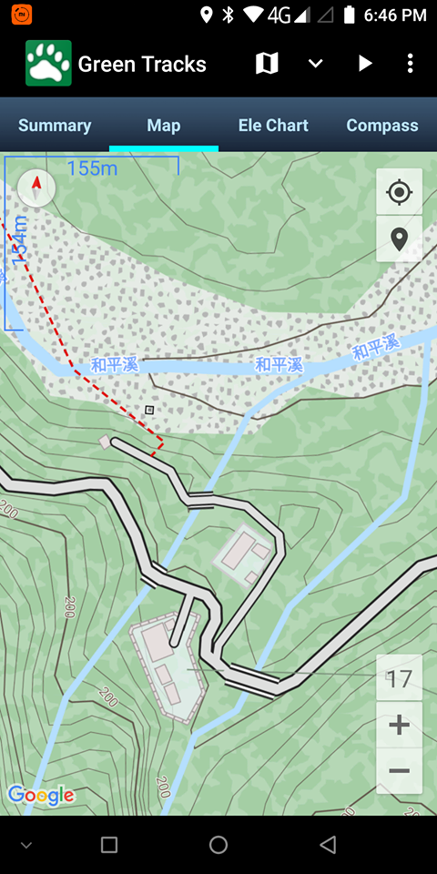
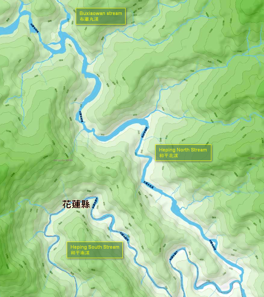
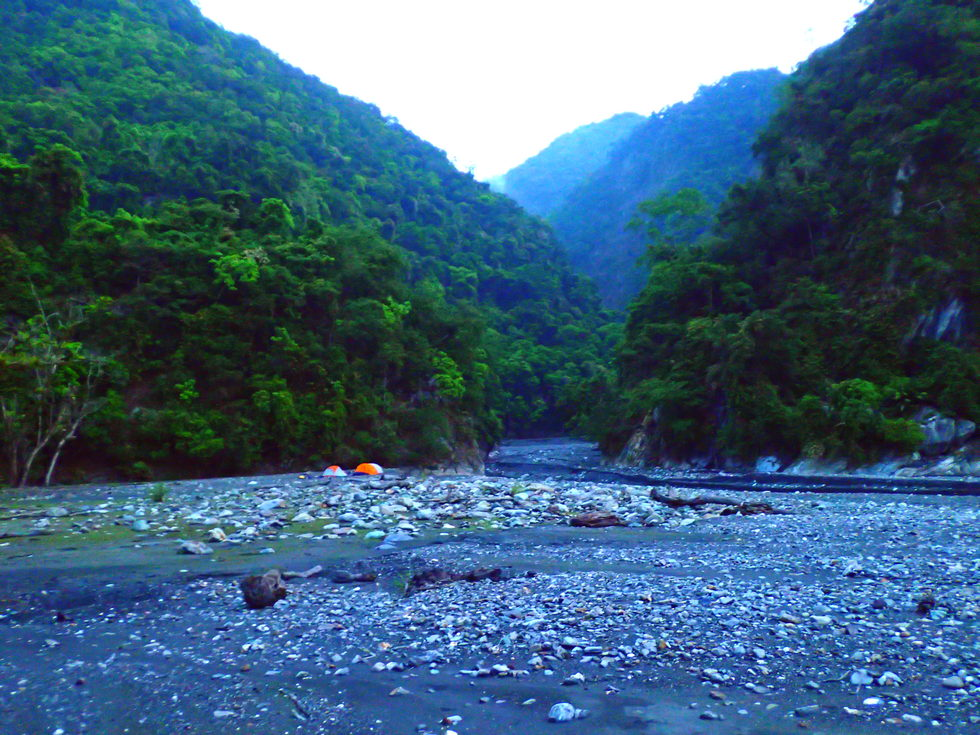
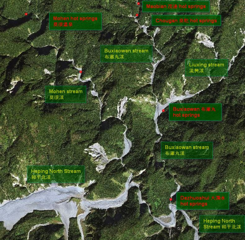
Packing to walk, we trace upstream along the Dazhuoshui river and take the north fork leaving the main river and following Heping North stream 和平北溪after approximately 1 km (24.3530073, 121.6634185). We continue northwest tracing Heping North stream to the confluence with Buxiaowan stream 布蕭丸溪 (24.4047427, 121.6261929) after 5-7 kilometers on the river. After about a 10 km walk and a steady easy climb from 100 to 300 m from the parking spot we have arrive at the campsite and last reported site for Dazhuoshui 大濁水 hot springs.
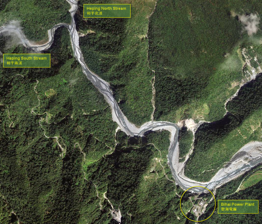
The Nanxi Dam 南溪壩, another 10 odd kilometers further in on the Heping forest road 和平林道, at an altitude of 545 meters, on the Heping South River 和平南溪 creates the Nanxi reservoir 南溪壩水庫 with a capacity of 635,000 m3 supplying water to the turbines at Bihai 碧海水力發電廠 after dropping 445 meters. Surveying for the dam began in 1996. Construction started in 2001 and the dam began operation in December of 2011 after project costs of NT$16.5 billion (US$ 569 million). An intake valve connects the dam at 545 meters altitude with a 6,549 meter long headrace tunnel to Bihai Power Plant 碧海水力發電廠 at an altitude of 100 meters where a vertical Pelton turbine generates 61.2 MW of power. The plant generates 237 GWh annually. 18 hours of daily water capture and storage generate enough electricity to supply six hours of peak load in the region.
The trail on the Green Tracks app suggests that people drove over the spillway on a lower road and parked there at the plant. Call the plant?
台灣電力股份有限公司和平施工處
電話: 03-868-2035
In 2018, we started hiking at 9 AM and arrived at BuXiaowan at 6:30 PM.
If we arrive at the confluence early enough, search for Dazhuoshui 大濁水 hot springs and investigate the colored runs on the opposite (south) side of the confluence basin.
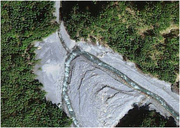
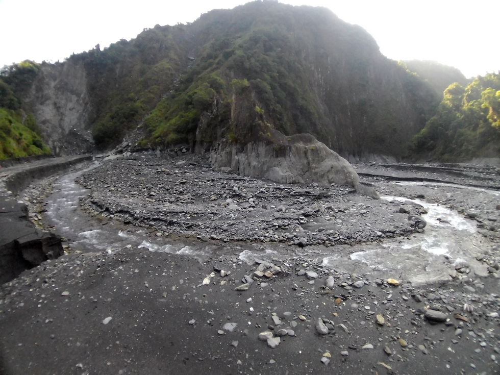
Mohen Confluence
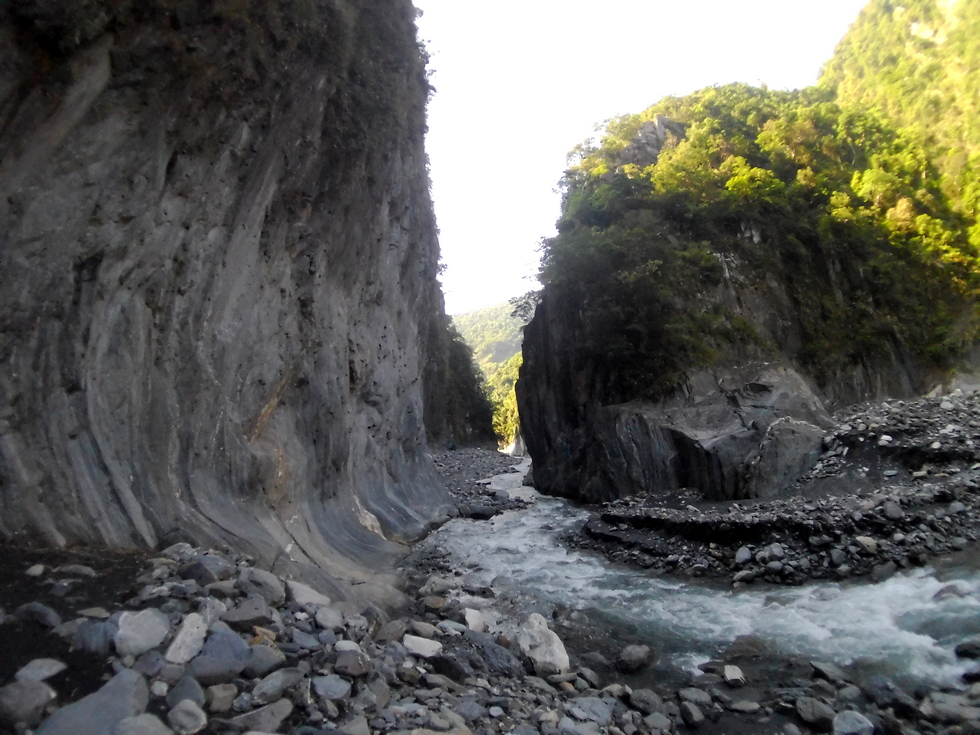
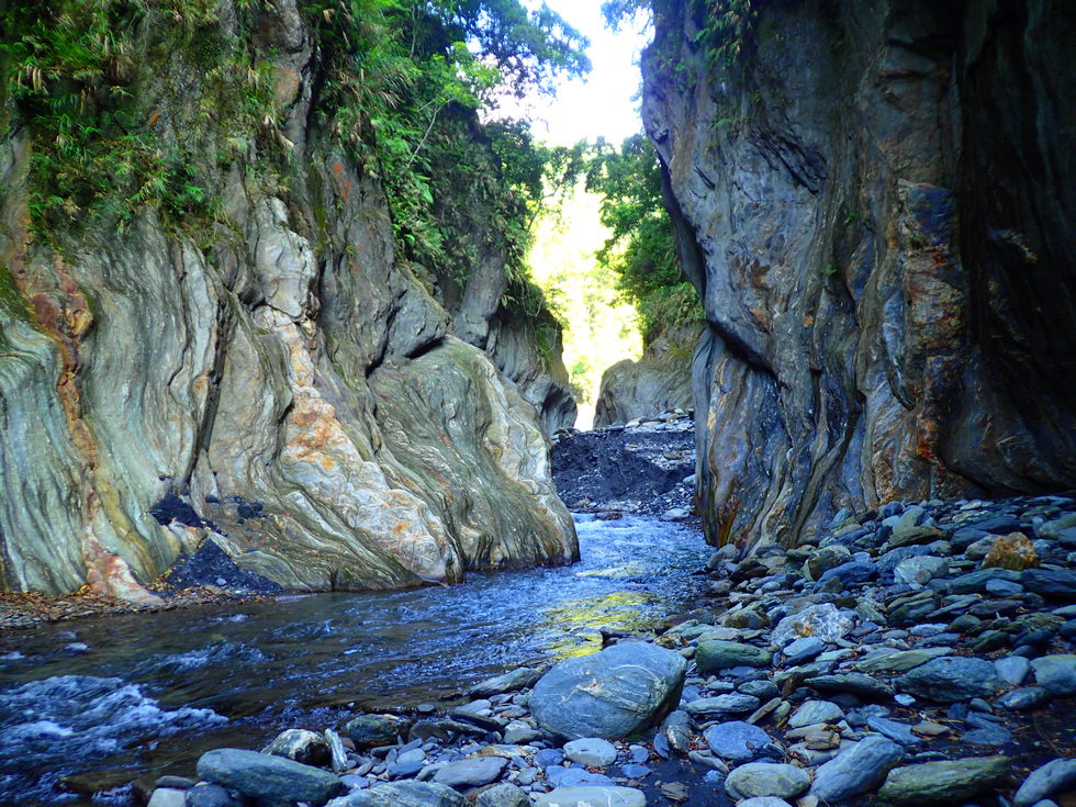
Mohen slot
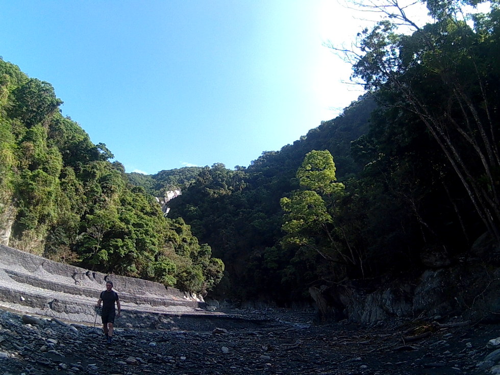
Turn around on Mohen stream in 2018
Consider searching for the trail over the Mohen peninsula for our return to camp to look for Buxiaowan 布蕭丸 hot springs at the confluence with Liuxing stream 流興溪 then trace down the Buxiaowan 布蕭丸 back to our basecamp.
Or, stay another at the basecamp another day and trace up the Buxiaowan stream the second day to the Liuxing stream 流興溪 to look for the hot springs.
return car, dinner
Sunrise: 5:43
Sunset: 18:11
Taiwan is a 36,000 square kilometer subtropical island. Steep mountains over 1,000 meters in elevation cover 32% of the island; hills and terraces between 100 meters and 1,000 meters make up 31%; while alluvial plains below 100 meters, where most human activity is concentrated, cover the remaining 37%. The northeast monsoon prevails from October through March. Typhoons and thunderstorms bring in abundant rainfall from May through September. The mountains are dominated by fractured, and deeply weathered metamorphic and sedimentary rock. Intense rainfall and flow of flood water causes severe erosion which is compounded by earthquakes which undermine the stability of the slopes. The rivers of the island are short and steep, becoming torrential during heavy storms. About 78 % of annual precipitation falls from May through October, with most water delivered by storms and typhoons. Average annual rainfall is 2,515 millimeters or 90.5 billion cubic meters. Average annual runoff is 66.8 billion cubic meters, of which only 23 % or about 15.4 billion cubic meters, are available for the use during the dry period from October through April. Annual pumped groundwater is estimated at 7.1 billion cubic meters.
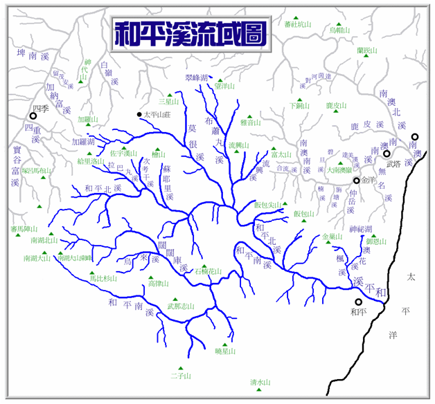
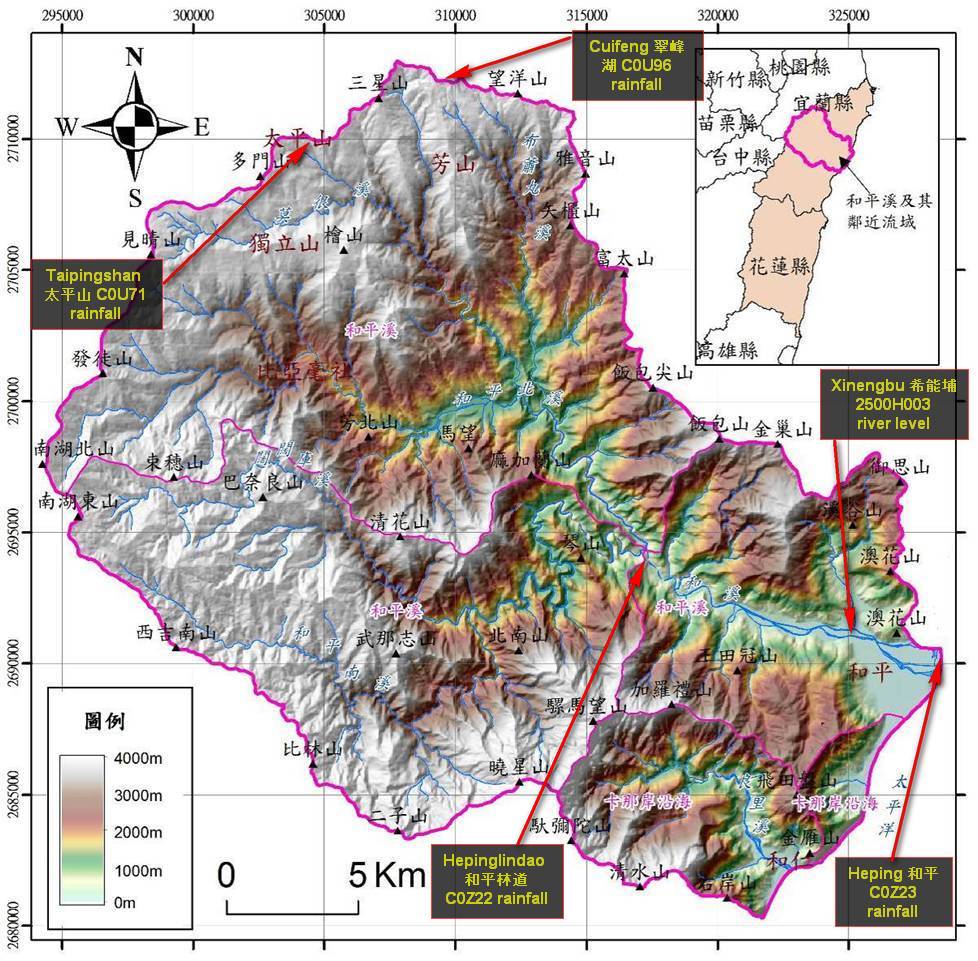
The Heping North river 和平北溪, Heping South river 和平南溪 Feng stream 楓溪 combined drain a 561 km2 watershed through the 48.2 km long river system originating from headwaters at Nanhuda mountain 南湖大山 at an elevation of 3,740 m in the central mountain range 中央山脈 flowing across Nanao township of Yilan county 宜蘭縣南澳鄉 and Xiulin township of Hualien counties 花蓮縣秀林鄉 before disgorging into the Pacific ocean on the island's east coast The Heping river system 和平溪水系 is administered by the First River Management Office 第一河川局 of the Water Resources Agency 水利署 under the Ministry of Economic Affairs 經濟部. The bureau operates Xinengbu 希能埔 (xī néng bù) river water level measuring station, Station number 站號 2500H005 on the Heping River 和平溪 in Heping Village 和平村.
River height 水位 (m) | Rainfall 雨量 (mm) | Rainfall forecast (avg POP next 24h) | |||||||
Date/Time | hour | day | hour | day | hour | day | |||
03/14 19:00 | 29.7 m | 0 mm | 0,5 | 0 % | |||||
03/15 13:50 | 29.3 | 0 | 0.5 | 20 % | 20 % | ||||
03/19 10:30 | 29.3 | 0 | 0.5 | 0 mm | 0.5 | 10 % | 20 % | ||
03/19 14:50 | 29.4 | 0 | 0.5 | 0 | 0.5 | 10 % | 15 % | ||
03/20 06:10 | 29.3 | 0 | 0 | 0 | 0 | 10 % | 10 % | ||
03/20 18:30 | 29.3 | 0 | 0 | 0 | 0 | 10 % | 10 % | ||
03/21 18:50 | 29.5 | 0 | 0 | 0 | 0 | 10 % | 10 % | ||
03/22 13:10 | 29.3 | 0 | 0 | 0 | 0 | 35 % | 35 % | ||
03/22 18:40 | 29.3 | 0 | 0 | 0 | 0 | 20 % | 30 % | ||
03/22 18:50 | 29.4 | 0 | 0 | 0 | 3.0 | 20 % | 30 % | ||
03/23 07:50 | 29.2 | 0 | 0 | 1 | 1.0 | 20 % | 30 % | ||
03/23 17:10 | 29.2 | 0 | 0 | 3 | 3 | 45 % | 25 % | ||
03/23 19:10 | 29.5 | 0 | 0 | 3 | 3 | 35 % | 30 % | ||
03/24 07:20 | 29.2 | 0 | 0 | 4.0 | 3.0 | 35 % | 25 % | ||
03/25 09:10 | 29.2 | 0 | 0 | 0 | 6.0 | 20 % | 25 % | ||
03/25 14:30 | 29.2 | 0.5 | 0.5 | 0 | 8.0 | 0 | 6.0 | 20 % | 35 % |
03/26 21:10 | 29.4 | 0 | 0.5 | 0 | 4.5 | 0 | 3 | 5 % | 10 % |
03/29 17:50 | 29.2 | 0 | 0 | 0 | 1.5 | 30 % | 30 % | ||
03/30 09:50 | 29.2 | 1.5 | 0 | 6.0 | 0 | 6.0 | 0 | 25 % | 30 % |
03/31 14:30 | 28.15 | 7.5 | 1.5 | 4.5 | 6.5 | 3.5 | 7.0 | 65 % | 35 % |
03/31 23:50 | 28.2 | 8.5 | 1.5 | 6.0 | 6.5 | 4.5 | 7.0 | 50 % | 45 % |
04/01 07:00 | 28.17 | 1.5 | 8.5 | 1.0 | 6.0 | 1.0 | 4.5 | 50 % | 40 % |
04/01 21:00 | 28.2 | 2.5 | 8.5 | 6.0 | 6.0 | 5.5 | 4.5 | 35 % | 35 % |
04/02 07:30 | 28.19 | 0 | 3.0 | 0 | 6.5 | 0.5 | 6.0 | 35 % | 30% |
04/02 15:00 | 28.19 | 0 | 3.0 | 0 | 6.5 | 0.5 | 6.0 | 60 % | 50 % |
04/03 05:20 | 28.19 | 0 | 0 | 0 | 0 | 0 | 0.5 | 65 % | 50 % |
04/03 13:50 | 28.19 | 0 | 0 | 0 | 0 | 0 | 0.5 | 55 % | 45 % |
Hydrological information is collected by the WRA (Water Resources Administration under the MOEA), CWB (Central Weather Bureau, and TPC (Taiwan Power Corporation) but not consistently integrated.
Heping River Water level
Location: 24.3245387,121.7433817; altitude 高程 (m) 28.000
this station is below the confluence so reflects volume of the entire watershed
Rainfall measurement in the Heping river watershed 和平流域
North and above the Heping drainage. This station is at Cuifeng 翠峰湖 in Taipingshan park
Precipitation Forecast
Discharge rates at Xinengbu 希能埔
Gauge (river height and rainfall) locations in watershed
https://gweb.wra.gov.tw/HydroInfo/?id=Index
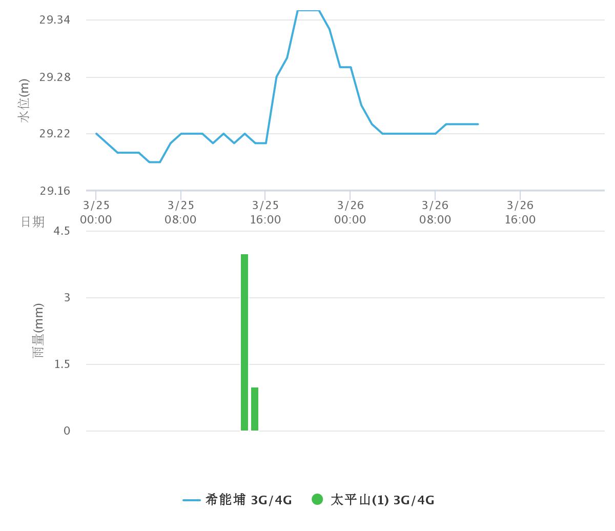
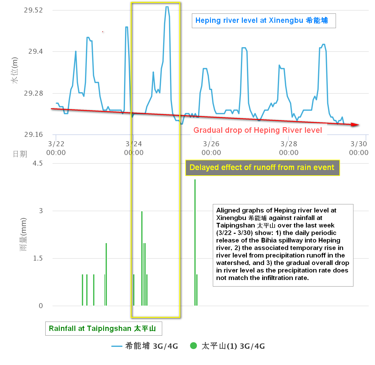
Aligning river height at Xinengbu 希能埔 (blue) with rainfall at Taipingshan 太平山 (green):
It takes roughly eight hours for a (5mm) rain event focused at Taipingshan to reach Heping. Then about 12 hours for the precipitation to all run off. The pattern over a month also clearly shows the daily spillway release.
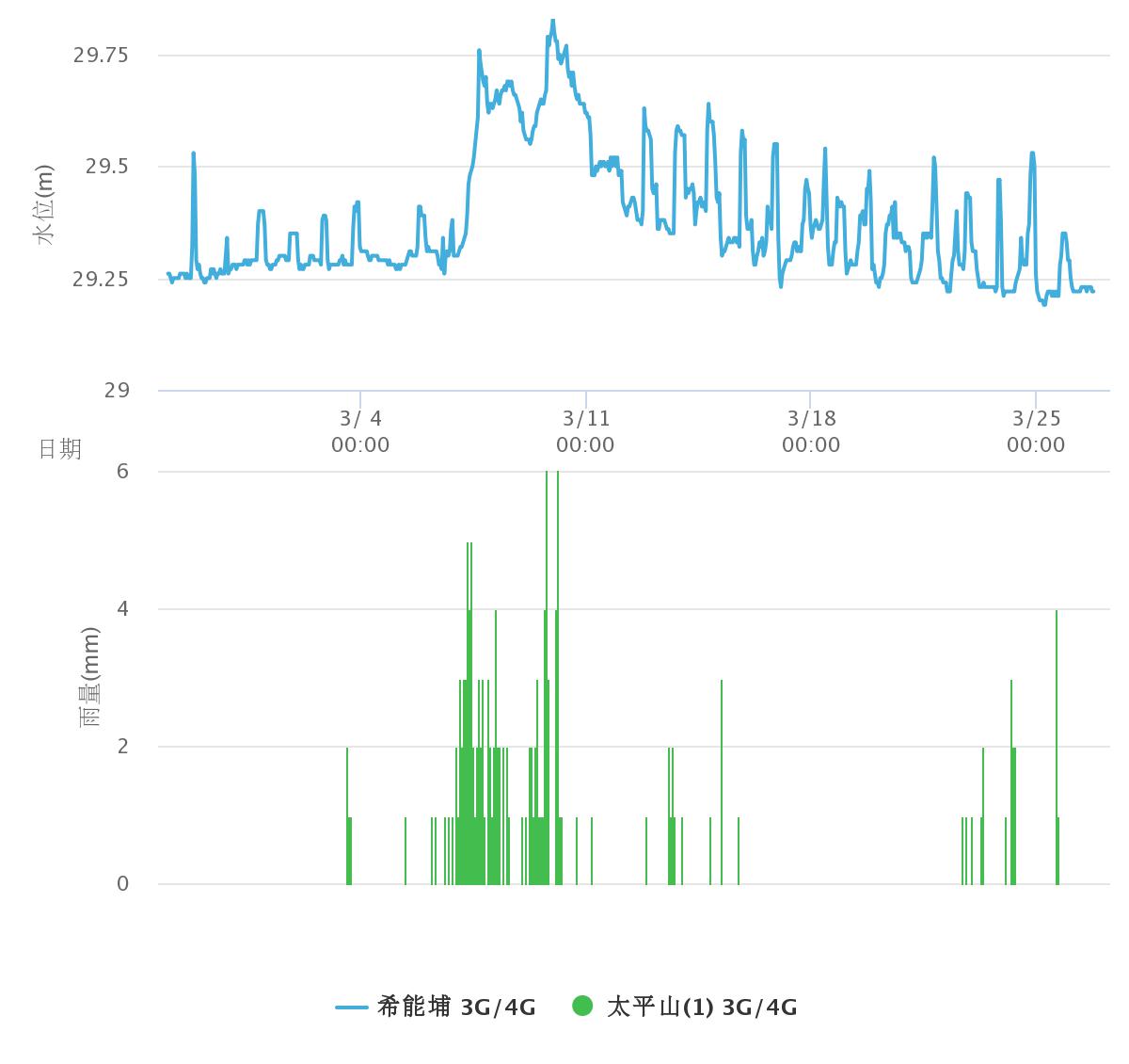
Aligned graphs of Heping river level at Xinengbu 希能埔 against rainfall at Taipingshan 太平山 over the last week (3/22 - 3/30) show: 1) the daily periodic release of the Bihia spillway into Heping river, 2) the associated temporary rise in river level from precipitation runoff in the watershed, and 3) the gradual overall drop in river level as the precipitation rate does not match the infiltration rate.
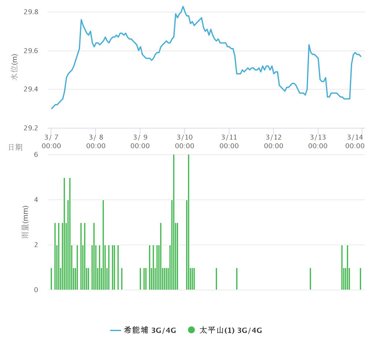
Inspecting the relationship between rainfall and river level from 3/7 - 3/15 from earlier this year suggests the recovery period for a multi-day 2-5 mm/hr drizzle seems to require just over 48 hours of no rain in the Heping watershed.
As of 17:00 on 4/1 the CWB forecasts continuing rain over the Heping watershed throughout the week.
river shoes, sandals
helmet, wet suit (optional), gloves (recommended), dry bag, walking stick (recommended), life jacket?
headlight, tent, sleeping bag, mattress
hat, water, sunscreen
stove(s), cooking pot, ropes, med kit
Permit issued
Date: Mar 22, 2019, 9:06 AM
From: moienpa@minister.moi.gov.tw
您的入山申辦序案號108032100203,已審核通過,附件為入山許可證及入山名冊,請於入山前列印相關文件,以利查驗。
宜縣警保山證字第 108BT09100577 號
停留期間: 108/04/04 ~ 108/04/06
前往地點: 和平溪上游(宜蘭縣,南澳鄉)
登山計畫書:
D1: 花蓮 -> 和平林道-> 布蕭丸
D2: 布蕭丸 -> 莫很溪 -> 布蕭丸
D3: 布蕭丸 -> 和平林道 -> 花蓮