Keywords:
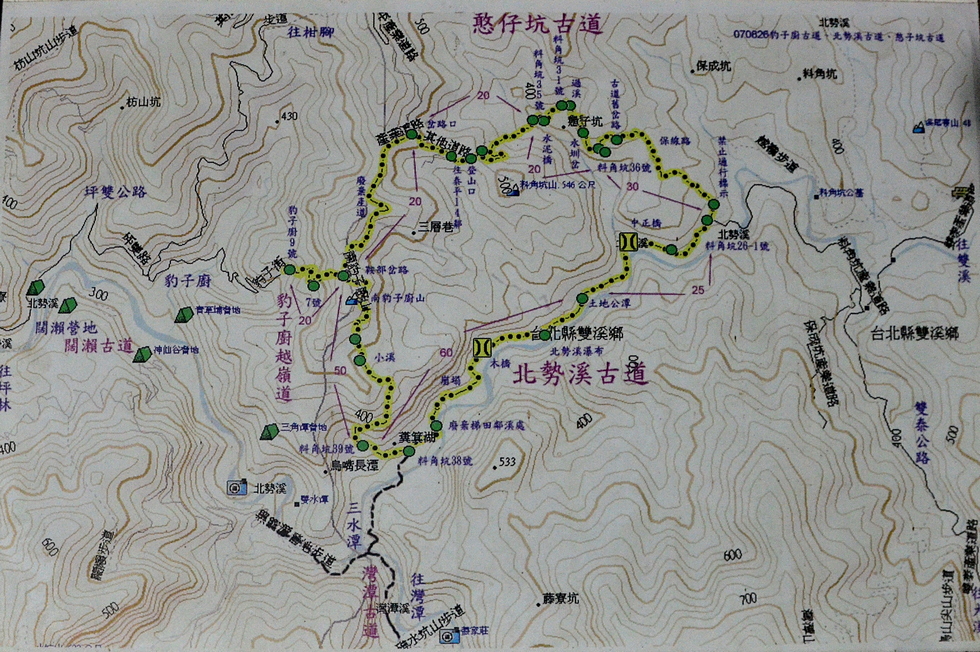
map Location: 24°58'6" N, 121°47'18" E, 426.4m; near:
Pinglin, 坪林,
map
Camera/lens: NIKON D7000, 17-50mm f/2.8
Aperture: 5.0, Shutter speed: 1/100, Focal length: 17.0 mm, ISO: 1600, Bias: 0
Date/Time: 2017:04:25 13:29:12
Average color:
gray57