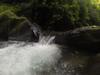
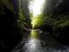
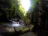
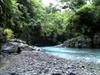
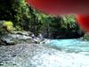
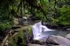
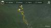
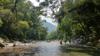
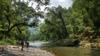
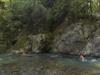
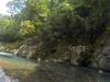
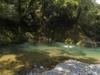
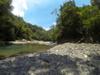
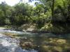
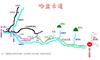
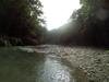
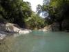
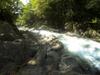
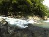
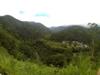
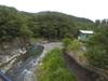
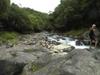
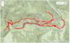
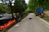
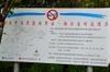
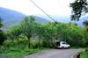
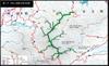
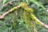
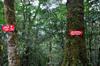
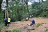
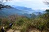
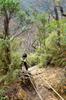
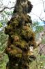
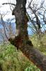
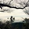
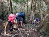
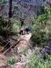
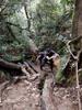
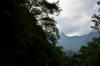
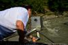
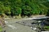
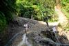
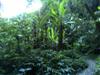
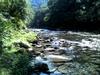
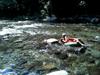
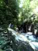
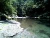
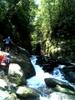
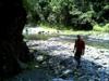
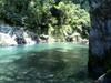
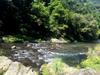
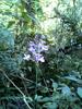
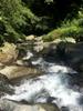
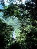
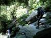
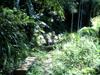
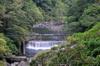
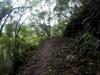
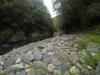
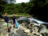
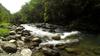
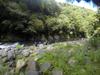
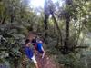
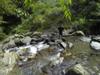
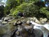
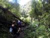
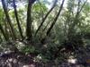
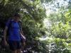
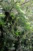
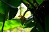
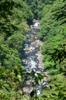
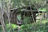
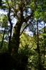
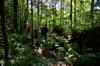
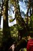
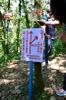
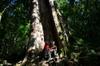
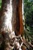
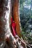
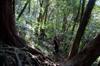
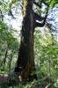
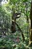
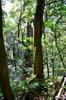
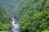
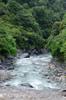
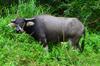
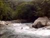
Fushan 福山

journal > locations > Fushan 福山: 2022 | 2020 | 2018 | 2017 | 2016 | 2015 | 2014 | 2013 | 2012 | 2010 | 2009 | 2008 | 2005 | 2002 | 2001


2022

DSC08075
Nanshi River 南勢溪
DSC08071
Nanshi River 南勢溪
GOPR0200
Nanshi River 南勢溪
GOPR0199
side canyon of Nanshi River 南勢溪
GOPR0197
waterfall
GOPR0195
side canyon of Nanshi River 南勢溪
GOPR0194
side canyon of Nanshi River 南勢溪
DSC08066
red spores
DSC08047
GOPR0192
side canyon of Nanshi River 南勢溪
GOPR0187
waterfall
GOPR0184-5_978x550G
waterfall (video)
GOPR0183
side canyon of Nanshi River 南勢溪
GOPR0179_980x720
Exploring a bat cave (video)
GOPR0176
Exploring a bat cave
GOPR0171
Exploring a bat cave
DSC08044
bats at rest
DSC08035
bats at rest
GOPR0169
Nanshi River 南勢溪
GOPR0165
Nanshi River 南勢溪
GOPR0161
Nanshi River 南勢溪
GOPR0159
Nanshi River 南勢溪
GOPR0151
Nanshi River 南勢溪
GOPR0149
Nanshi River 南勢溪
GOPR0147
Nanshi River 南勢溪
GOPR0145
Nanshi River 南勢溪
DSC08011
Nanshi River 南勢溪
DSC08008
Nanshi River 南勢溪
GOPR0142
Nanshi River 南勢溪
GOPR0139
Nanshi River 南勢溪
GOPR0137
Nanshi River 南勢溪
DSC07993
fisherman at the slot entrance
DSC07982
butterfly in elder

2020

IMG_20200201_162720_0
trail to check out above Lanhou falls 蘭吼瀑布 on Wuzhong stream 五重溪
IMG_20200201_161009_2
clearcut forest near the top of Lane 120
IMG_20200201_155306_9
workhouse at the end of Lane 120
IMG_20200201_155125_8
the end of Lane 120 at 980m elevation

2018

IMG_20181222_122138_7
Nanshi stream 南勢溪
IMG_20181222_121837_1
IMG_20181222_120955_1
Nanshi stream 南勢溪
IMG_20181222_120217_1
Hapen 哈盆
IMG_20181222_115741_9
IMG_20181222_115720_1
Turn off to Hapen
IMG_20181222_115715_0
IMG_20181222_113105_1
arch of former railway bridge
IMG_20181222_110924_2
VID_20181222_105634-154934_960x540
Hapen trail 哈盆越嶺步道 (video)
IMG_20181222_104313_3
VID_20181222_103030-143710_960x540
Hapen trail 哈盆越嶺步道 (video)
IMG_20181222_101407_0
IMG_20181222_085310_9
Bruce crossing a landslide
DSC00001
neglected suspension bridge in Fushan
DSC00009
the beach
DSC00005
looking down stream
DSC00004
Mario and Greg at the beach crossing
DSC00003a
Corina, Mario, Jessie and Greg
IMG_2210
house number of the abandoned house at fish pond on stream
DSC_1134
man-made reservoirs
DSC_1133
irrigation canal
DSC_1126
Dan coming up the steep trail
DSC_1125
looking up Siqiye stream 斯其野溪
DSC_1122
DSC_1119
Dan crossing a slide in thetrail
DSC_1116
Taiwan Macaque 台灣獼猴 (táiwān míhóu) Macaca cyclopis
20180526_153542
Lanyang River 蘭陽溪
20180526_151824
Lanyang River 蘭陽溪

2017

Fushan_8_12-13
Fushan overnight
4105351311_strava_1502638269911_640x480
Fushan overnight (map video)
20170813_133414
Nanshi stream 南勢溪
20170813_073915
Nanshi stream 南勢溪
20170813_133316
Nanshi stream 南勢溪
GOPR2685
Nanshi stream 南勢溪
GOPR2682
Nanshi stream 南勢溪
GOPR2678
noon swim
GOPR2677
once big bend deep pool
GOPR2676
once big bend deep pool
GOPR2674
side stream canyon
GOPR2671
coming out of the side stream canyon
GOPR2669
explore of the side stream canyon
GOPR2663
explore of the side stream canyon
GOPR2660
hiking up to the side canyon
GOPR2658
morning swim
20170813_073920
James at camp
20170812_153142
James at camp
GOPR2657
morning at camp
GOPR2656
morning at camp
GOPR2649_640x480
swimming in the rain (video)
GOPR2653
swimming in the rain
GOPR2648_640x480
Guga swimming in the rain (video)
GOPR2646
raining on Nanshi stream 南勢溪
GOPR2643
Nanshi stream 南勢溪
GOPR2642
Nanshi stream 南勢溪
GOPR2640_640x480
side stream canyon (video)
GOPR2639
first visit of side stream canyon
GOPR2635
James in the stream at camp
20170812_153100
at camp
GOPR2632
camp
GOPR2628
upstream from campsite
GOPR2627
down to Nanshi stream 南勢溪
GOPR2622
down to Nanshi stream 南勢溪
20170812_114502
down to Nanshi stream 南勢溪
54c8a54ef0707
simple hiking map
Fushan_0805_map
Nanshi stream 南勢溪 hike and trace
Relive_0805
(video)
GOPR2620
packing up 3:30 PM
GOPR2618
looking downstream
GOPR2617
down to the swimming hole
GOPR2613
Nanshi stream 南勢溪
GOPR2612
Nanshi stream 南勢溪
GOPR2611_640x480
shallow Nanshi stream 南勢溪 (video)
GOPR2610_640x480
Nanshi stream 南勢溪 (video)
GOPR2609
deer carcass
GOPR2606_640x480
Nanshi stream 南勢溪 diving (video)
GOPR2604
break for lunch and swim
GOPR2599_640x480
Nanshi stream 南勢溪 (video)
GOPR2598_640x480
Nanshi stream 南勢溪 (video)
GOPR2597
a small side slot canyon stream
GOPR2592
once big pool in bend
GOPR2589
at the once was big bend with deep pool
GOPR2586_640x480
(video)
GOPR2585_640x480
(video)
GOPR2583
inflating
GOPR2582
Nanshi stream 南勢溪
GOPR2581
upstream Nanshi stream 南勢溪 11:10
IMG_3761
GOPR2580
down to the river
GOPR2579
leaving the path
GOPR2577
Leigh on the trail
GOPR2576
Bolu stream 波露溪 10:25 AM
GOPR2575
Bolu stream 波露溪 downstream
IMG_3746
coming down to Bolu stream 波露溪
GOPR2574
crossing a minor new slide
GOPR2573
white mushroom
GOPR2572
looking down the first stream
GOPR2570
break in the first steam
IMG_3678
crossing the Soudelour landslide 9:20 AM
GOPR2562
Fushan 福山 Tanapavana village
GOPR2557
looking upstream
GOPR2555
4.76 ?
GOPR2553
Kalamoji 卡拉模基
GOPR2544
leaving the beach after lunch
GOPR2542
leaving Wendy and Tammy at the beach
GOPR2541
swimming beach
GOPR2521
down to the Nanshi stream 南勢溪
GOPR2519
looking downstream
GOPR2518
above Fushan 福山
GOPR2514
out of the Hapen trail 哈盆越嶺步道
GOPR2511
slide below the end of the road
GOPR2501
Wendy and Bruce have crossed
GOPR2500_854x480
across the slide
GOPR2495_854x480
Wendy crossing
GOPR2499
new trails form across new slides
GOPR2493
Wendy coming across the big new slide
GOPR2491
back across the big slide
GOPR2489
the Nanshi river 南勢溪 below
GOPR2399
this stream has changed since Soudelour
GOPR2398
picnic in the stream
19125497_10158635617150417_1187584677_o
Lanyang River 蘭陽溪. delta
19074605_10158635617185417_2121503038_o
Lanyang River 蘭陽溪. delta
19104883_10155842818292289_1316977451_o
crossing the Lanyang River 蘭陽溪
20170527_092247
VIDEO0020
Bridge replacement at Lanhou waterfall 蘭吼瀑布
IMAG0168
Bridge work over Wuzhong stream 五重溪

2016

video
jump into the Nanshixi 南勢溪
Fushan_2016-08-13_640x360
float down the Nanshixi 南勢溪
IMAG0156
alluvial agriculture in the Lanyang River 蘭陽溪
IMAG0152
Lanyang River 蘭陽溪
IMAG0147
Lanyang River 蘭陽溪
IMAG0146
alluvial agriculture in the Lanyang River 蘭陽溪
IMAG0145
big tree at Bailing 白岭巨木
image1
IMAG0132
IMAG0131
IMAG0130
Jack dismayed at broke seat post
IMAG0129
Starting point
IMAG0128
DaTong 大同 map
hike
5k hike
drive_and_walk
driving route
DSC_7881
DSC_7880
entire watershed closed to fishing
DSC_7878
Nanji working with bamboo
DSC_7876
trail head to BeiChaTianShan 北插天山
IMG_7230
wld bee trap
DSC_7874
DSC_7872
Wild lupine 原生羽扇豆 (yuánshēng yǔshàn dòu), 魯冰花 (lǔ bīnghuā) Lupinus perennis
DSC_7864
DSC_7863
DSC_7862
abandoned house?
DSC_7861
DSC_7859
DSC_7857
DSC_7856
DSC_7854
DSC_7853
DSC_7848
DSC_7846
IMG_7223
IMG_7220
DSC_7845
DSC_7843
DSC_7842
DSC_7838
DSC_7836
IMG_7205
DSC_7835
the end of the road
IMG_7204
IMG_7201
DSC_7831
typhoon redesign
IMG_7192
DSC_7830
IMG_7185
DSC_7824
IMG_7183
DSC_7818
IMG_7181
eutrophication?
DSC_7815
DSC_7811
the trail skirts fenced property
DSC_7810
DSC_7809
DSC_7808
looking north toward ChaTian
IMG_7172
DSC_7805
coming down to the stream
DSC_7800
erosion in the earthworks
DSC_7799
DSC_7796
DSC_7794
roads of the development ahead
DSC_7791
more fences on the trail
IMG_7168
wild bee trap
DSC_7790
DSC_7788
recently extracted trees
DSC_7786
DSC_7782
development across the valley
DSC_7774
trail head at fenced off road
DSC_7770
happy Buddha
DSC_7767
butterfly cage?
DSC_7766
DSC_7765
a complex of cages
DSC_7763
cages
DSC_7757
goats
DSC_7753
racoon caged
DSC_7744
12467779_10206574200132044_366537781_n
Out after dark.
strava_map
17.6 k, 1482 m climb in 10 hours
ChaTianShan
map of trails of Chatianshan Reserve 插天山自然保留區
DSC_7313
back to the ticket booth 6:30 PM
DSC_7312
DSC_7309
path to XiaoWuLai 小烏來
DSC_7307
DSC_7306
DSC_7304
break at cabin ruins 木屋遺址 at the base of the vertical climb
DSC_7303
DSC_7300
DSC_7295
DSC_7293
DSC_7292
DSC_7291
DSC_7289
DSC_7288
DSC_7287
down to the west
DSC_7283
many ropes
DSC_7282
DSC_7281
DSC_7280
DSC_7279
DSC_7277
DSC_7276
the hike back down
DSC_7274
muddy trail on the ridge
DSC_7272
DSC_7269
10407293_10156340414215612_2155046391854702056_n
Disturbance brings more erosion
DSC_7267
looking south
DSC_7266
DSC_7265
DSC_7264
DSC_7262
20 mins to BeiCha, 20m higher
DSC_7261
DSC_7260
10398084_10156340414120612_3875570079675435658_n
Lunch at the top.
DSC_7258
trail to 南插天山
DSC_7255
DSC_7254
DSC_7252
looking south
DSC_7251
looking south
12468084_10206578295114416_696302850_n
We were lucky that it was "dry"
DSC_7250
12459925_10206578297194468_389098662_n
up the muddy root trail
12400780_10156340414065612_5464043292932700440_n
DSC_7247
looking west
12476498_10206578296114441_271225909_n
like a Japanese ink painting
12459525_10206578296994463_359049689_n
Nearly 90 degree climbs
12463970_10206578295834434_1708093800_n
sedimentary rock exposed on a ridge
12463947_10206578296394448_1252498649_n
12483890_10206578296914461_1804099953_n
A good view of the erosion along the path
1013323_10156340414770612_4283385764167301133_n
using the roots to climb
12476119_10206578294594403_1209667805_n
1327_10156340414850612_1087787380692855857_n
1743469_10156340414565612_2369677451767030329_n
DSC_7240
DSC_7239
1158_10156340414420612_8942194420734391466_n
Glam shot on the ropes
DSC_7236
ladders make the slippery clay passable
DSC_7232
DSC_7230
1656203_10156340414335612_9037490737317992102_n
Coming up for a breath
DSC_7229
DSC_7227
Full-body work out
DSC_7222
up, up, up
DSC_7217
long climb through the roots and mud
12373391_10156340414705612_1955482711488026671_n
Erika with the tree not cut down
DSC_7212
DSC_7210
DSC_7209
DSC_7208
fines for extracting natural material
DSC_7206
lower trail toward XiaoWuLai 小烏來
DSC_7204
peeling beech?
DSC_7202
DSC_7201
muddy trail
DSC_7199
DSC_7196
woodpecker work on a dead crepe myrtle tree
DSC_7195
15 mins to Dongyanshan 東眼山 trail
12400699_10156340415020612_1303065359376682017_n
over a landslide
12467987_10206578298154492_1847586315_n
a handmade net to keep people from falling down the mountain
1497181_10156340415120612_2162762621276027181_n
The slide area formed after Typhoon Soudelour 蘇迪羅
DSC_7194
DSC_7192
coming up to the DongYanShan trail
12467846_10206578297514476_519584695_n
planted cypress
DSC_7191
trail to DongYanShan 東眼山
DSC_7190
DSC_7187
12460112_10206578299994538_4480372_n
DSC_7185
DSC_7182
DSC_7181
bridge out
DSC_7179
DSC_7177
12483763_10206578299234519_2117250370_n
through the park
12347785_10156340414495612_5822117473349572680_n
1544328_10156340414975612_3935669615750736896_n
Walking through the replanted forest
DSC_7173
on the park trails
DSC_7171
12468180_10206578298914511_2026297959_n
into the park
DSC_7170
DSC_7167
park damaged
DSC_7165
in the park
DSC_7164
Ruizi stream 蚋仔溪
DSC_7163
tickets and walking at 8:45 AM

2015

hapen-hike
10.3k walk
DSC00038
upstream
DSC00032
former swimming hole
DSC00030
downstream
DSC00027
former swimming hole
DSC00018
second slide, downstream
DSC00014
second slide, upstream
DSC00013
first slide, road at top
DSC_6384
road work over Wuzhong stream 五重渓
DSC_6375
at Lanhou waterfall 蘭吼瀑布
DSC_6381
road work over Wuzhong stream 五重渓
DSC_1790
(photo by BB)
DSC_6372
Lanhou waterfall 蘭吼瀑布
DSC_6370
Wuzhong stream 五重渓
DSC_6369
Bernard and Ah-bao go down to the stream
DSC_6368
Lanhou waterfall 蘭吼瀑布
DSC_6367
waiting for the road to clear
DSC_6359
Wuzhong stream 五重渓
DSC_6357
A-bao and Bernard inspect the road work
DSC_6356
Lanhou waterfall 蘭吼瀑布
DSC_6355
DSC_6345
Algis supervising
DSC_6342
Lanhou waterfall 蘭吼瀑布
DSC_6334
clearing a slide
DSC_6333
Nanshixi river 南勢溪 below
DSC_6328
slate 頁岩 (yèyán) ardoise
DSC_6327
DSC_6326
DSC_6323
Ah-bao on the road
DSC_6319
DSC_6317
Cuntun 村屯
DSC_6315
DSC_6313
road damage everywhere
DSC_6312
DSC_6310
inspecting the Kalamoji water gauge
DSC_6304
upstream from the Kalamoji bridge
DSC_6303
DSC_6302
Ah-bao on the Hapen access road
map_track_Peter
river hike map
DSC00129
1.5K
DSC00127
2K
DSC00125
footbrdige nearing end of life
DSC00122
experiment in progress
DSC00121
banana patch
DSC00118
3K
DSC00117
Up to the Hapen trail
DSC00110
trail up from the river
DSC00109
DSC00108
DSC00107
DSC00099
DSC00098
DSC00097
DSC00092
DSC00086
DSC00080
side canyon
DSC00075
DSC00074
DSC00073
round river rocks
DSC00071
DSC00066
DSC00063
DSC00061
DSC00060
DSC00054
narrows
DSC00053
Bruce
DSC00049
approaching the narrows
DSC00045
view downstream
20329551392_e434691e14_o
20311771816_092ff3f7e5_o
DSC00036
orchid
20150010058_a225d6b909_o
DSC00025
20338028615_72c9e0c145_o
20344094681_478c56c146_o
Brent
20311769956_3793fff1c7_o
DSC00015
crossing the first stream
19717038833_8535a3fc08_o
Philip at the start
Fushan_hike
9.3k Fushan river hike
DSC00103
卡拉莫基山 Kalamoji mtn; 波露山陵線 Bolu mtn ridge
GOPR1554
beehives along the trail
GOPR1553
the rock skippers
DSC00089
rock skippers
DSC00084
Philip and Poppy
DSC00081
DSC00077
DSC00076
swimming spot
GOPR1550
fallen tree seeds
GOPR1547
ground orchid with white flowers
GOPR1546
wild bean
DSC00068
trail sign
GOPR1545
big tree
GOPR1544
Poppy finds water
GOPR1542
stream crossing
GOPR1541
ginger or banana?
GOPR1540
ground orchid
GOPR1536
thick-leaved ground vine
DSC00058
experiment in progress
GOPR1535
wild ginger
DSC00055
stream full of people
DSC00051
GOPR1533
DSC00048
exploring plants along the trail
DSC00044
the Nanshi stream 南勢溪 below
DSC00039
dry stream bed crossing
DSC00017
Tammy pixelated
DSC00007
Wendy and Tammy studying plants
DSC00003
in the bamboo forest
DSC_4426
Starting point, from the parking lot near Kapu Village.

2014

DSC00050
DSC00037
DSC00026
starting
DSC00024
down to the Nanshi stream 南勢溪
DSC00022
DSC00010
the trail passes under a recently fallen huge tree
DSC_3776
Atayal origins
DSC_3775
Local plants in Atayal
DSC_3774
local animals in Atayal
DSC_3773
Atayal iconography
DSC_3771
DSC_3769
DSC_3767
log steps wrapped with wire
DSC_3766
IMG_4469
DSC_3764
Dan crossing a new slide area
DSC_3761
irregular spider web
DSC_3760
Begonia 水鴨腳秋海棠 (shuǐyājiǎo qiūhǎitáng) Begonia formosana
DSC_3759
female Staff Sergeant 單帶蛺蝶 (dān dài jiá dié) Athyma selenophora laeta Nymphlidae
IMG_4462
male Athyma selenophora laeta Nymphlidae 單帶蛺蝶 (Dān dài jiá dié)
DSC_3755
turn off to 茶墾山 (chá kěn shān) and 模故山 (mó gù shān)
IMG_4458
female Muirhead's ladyrinth 永澤黃斑蔭蝶 (Yǒngzé huángbān yīn dié) Neope muirheadi nagasawae Nymphalidae, Satyrinae
DSC_3754
fern in tree
DSC_3753
vine
DSC_3752
vine
DSC_3751
Hardy Calanthe Orchid 反捲根節蘭 (fǎn juǎn gēn jié lán) Calanthe reflexa (Kuntze) Maxim.
DSC_3750
DSC_3749
保安林界
DSC_3746
Forest-dwelling calanthe 長距根節蘭 (cháng jù gēn jié lán) Calanthe sylvatica (Thouars) Lindl.
DSC_3743
IMG_4450
DSC_3741
White-eared Sibia 白耳畫眉 (bái ěr huàméi) Heterophasia auricularis
DSC_3734
IMG_4440
Formosan piedwing 中華珈蟌 (zhōnghuá jiā cōng) Psolodesmus mandarinus mandarinus
DSC_3733
IMG_4436
DSC_3729
female Swinhoe's Pheasant 藍腹鷳 (lán fù xián) Lophura swinhoii
DSC_3723
female Swinhoe's Pheasant 藍腹鷳 (lán fù xián) Lophura swinhoii
IMG_4435
DSC_3721
IMG_4431
DSC_3720
DSC_3717
DSC_3716
slippery when wet
DSC_3715
DSC_3711
DSC_3709
the trail along cliffs with ropes
DSC_3708
stream above our campsite
DSC_3705
DSC_3704
DSC_3703
DSC_3693
Forest-dwelling calanthe 長距根節蘭 (cháng jù gēn jié lán) Calanthe sylvatica (Thouars) Lindl.
DSC_3692
Hardy Calanthe Orchid 反捲根節蘭 (fǎn juǎn gēn jié lán) Calanthe reflexa (Kuntze) Maxim.
DSC_3691
turn off to 茶墾山 and 模故山 with 1 hr of light left
DSC_3689
DSC_3688
trail to 札孔山 and 李茂岸山
DSC_3686
repaired road visible on the road to the Hapen trail 哈盆越嶺步道 head across the valley
DSC_3685
suspension bridge over Yakongxi stream 軋孔溪 at the Fu-Ba trail 福巴越嶺古道 head
DSC_3684
the Fu-Ba trail 福巴越嶺步道 is closed due to damage from typhoon Matmo 麥德姆颱風
DSC_3683
Fu-Ba trail 福巴越嶺古道 head bridge over Yakongxi stream 軋孔溪
GOPR1111
back to the car
GOPR1109
hunting dogs?
GOPR1099
road looking improved
GOPR1098
back up to the road
GOPR1095
GOPR1091
on the return path
GOPR1086
Hiroshi straightening up the beach
GOPR1085
GOPR1082
GOPR1079
GOPR1078
Hiroshi's descent (video)
GOPR1074
Bruce's flush (video)
GOPR1073
Brent's flush (video)
GOPR1072
Greg's flush (video)
GOPR1071
Hiroshi's flush (video)
GOPR1067
the Nanshi stream 南勢溪
G0041060
Hiroshi taking warmth from the stones
GOPR1030
the Nanshi stream 南勢溪 (video)
GOPR1027
down to the Nanshi stream 南勢溪
GOPR1022
leaving the Hapen trail 哈盆越嶺古道 to go down to the river
G0030983
Greg crossing Bolu stream 波露溪
G0010927
Hiroshi and Brent crossing the Bolu stream 波露溪
GOPR0921
GOPR0917
many steep paths lead down to the river
GOPR0912
GOPR0907
Hapen trail head 哈盆越嶺古道
GOPR0903
trucks of hunting dogs at the trail head
GOPR0901
Taiwan Lily 台灣百合 Lilium formosanum are just starting to flower, planted all along the road
GOPR0891
Bamboo forest clear cut at the head of the Fushan-Baling Trail 巴福越嶺古道
GOPR0886
Brent approaches the machine
GOPR0879
the road is closed to repair a landslide
image
Lanhou falls 蘭吼瀑布 on Wuzhong stream 五重溪 on the road to Fushan 幅山
DSC_3579
Fushan village 福山
DSC_3578
road work
DSC_3576
much shorter trail to beach
DSC_3575
DSC_3573
Atayal beehive
DSC_3571
DSC_3567
poppy swimming in vest
DSC_3564
poppy
DSC_3561
DSC_3560
ferns in the trees
DSC_3559
banana flower
DSC_3543
Bruce and Poppy
DSC_3540
Nanshixi 南勢溪
DSC_3533
DSC_3532
Don't pick the private bamboo!
DSC_3530
cyclist on the suspension bridge at the head of the FuBa trail 巴福越嶺
DSC_3527
bamboo harvest at the head of the FuBa trail 巴福越嶺
DSC_3526
new water level meter at bridge
DSC_3525
Lanhou falls 蘭吼瀑布 on Wuzhong stream 五重溪
DSC_0086
DSC_0085
DSC_0084
DSC_0082
DSC_2362
just below the peak of Beichatianshan 北插天山
DSC_2357
DSC_2352
DSC_2351
DSC_2345
DSC_2342
DSC_2341
DSC_2340
DSC_2338
remains of eaten whistling thrush
DSC_0079
DSC_2336
DSC_2335
DSC_2332
DSC_2328
DSC_2326
DSC_2323
DSC_2321
DSC_2320
DSC_2317
group photo
DSC_2316
DSC_0077
DSC_2314
DSC_2313
DSC_2312
DSC_2311
DSC_2310
DSC_2309
DSC_2308
DSC_2307
DSC_2306
DSC_2305
DSC_2304
DSC_2301
DSC_2300
DSC_2299
DSC_2298
DSC_0073
DSC_2297
DSC_2295
DSC_2293
DSC_2292
DSC_0071
DSC_0070
DSC_0069
DSC_0068
DSC_2291
DSC_2288
DSC_2287
DSC_2285
DSC_2284
DSC_2280
DSC_0067
DSC_0065
DSC_0064
DSC_0063
DSC_0062
DSC_0061
DSC_0060
DSC_2278
DSC_0057
DSC_2275
DSC_0055
DSC_2273
DSC_2272
DSC_2271
DSC_2270
DSC_2265
DSC_2264
DSC_2263
DSC_2261
DSC_2259
DSC_2257
DSC_2254
DSC_2252
DSC_2251
DSC_2249
DSC_2248
DSC_2247
DSC_0054
DSC_2245
scat
DSC_2243
DSC_0048
DSC_0046
DSC_2241
DSC_2238
DSC_2237
DSC_2236
DSC_2234
DSC_2233
DSC_2232
DSC_2229
DSC_2227
DSC_2225
trail to Suànwēi mountain 蒜威山
DSC_0041
DSC_2223
DSC_2197
Last swig of coffee for Tammy as Alan and Sandra wait to take off
DSC_2196
Starting point, from the parking lot near Kapu Village.

2013

DSC_1027
DSC_1023
DSC_1021
looking downstream on the Nanshixi 南勢溪 from the Fushan 福山 bridge
DSC_1019
water buffalo 水牛 Bubalus bubalis
fushan_2013-07-21
Fushan river crawl video

2012

IMG_3217
IMG_3198
strava
97.1 k ride to Mingchi 明池
beiheng_2012-9-9_SD
97.1 k ride to Mingchi 明池

2010

20739
local farmers sell their produce to the visitors
20718
Looking over the water area that has become a popular play area
20322
20317

2009

16450
Tammy
16407
Kalamoji 卡拉莫基 qlang krmut
033
first narrows, 11 AM
022
down to the water just below Lumen stream 露門溪, near 4.5k at 10:30 AM
014
construction over the Nanshi stream 南勢溪, 8:30 AM
15281
Joshua engages the fishermen
14800_dan_5707
Jeff and Philip (photo by Dan)

2008

DSC_2269

2005

DSCN0704
DSCN0703
DSCN0702
DSCN0701
a place to swim
DSCN0700
DSCN0541
Fushan bridge
DSCN0540
out, 16:15
DSCN0536
Nanshixi 南勢溪
DSCN0534
Fushan bridge
DSCN0533
DSCN0530
abandoned civilization
DSCN0526
bamboo
DSCN0524
Phoenix and Zephyr
DSCN0521
Russ and Phoenix
DSCN0519
McClays
DSCN0518
DSCN0516
DSCN0514
construction begins
DSCN0512
Dorma
DSCN0510
down to the water just above Fushan village, 1:15
DSCN0508
Lanhou waterfall 蘭吼瀑布
DSCN0507
Dorma and Tammy
Fushan_tm2
2m Landsat of Fushan area
Fushan_topo
Fushan area hiking map

2002

p5050006
Tammy
p5050003
Dan swimming

2001

P1010047
back to Fushan 福山
Browse by: Years | Keywords | Locations | People