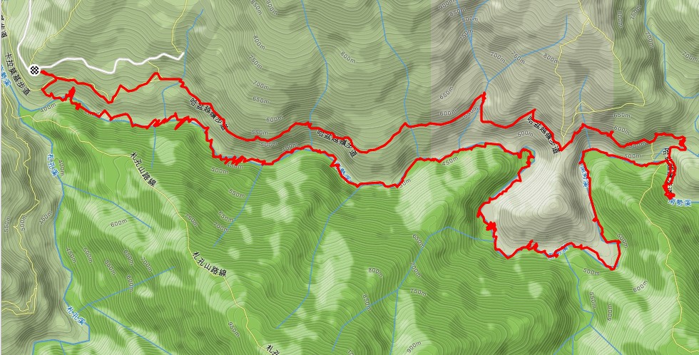
Nanshi stream 南勢溪 hike and trace
journal
>
2017
>
Fushan 福山
> Nanshi stream 南勢溪 hike and trace
Nanshi stream 南勢溪 hike and trace
Keywords:
hike
,
map
Location: 24°46'32" N, 121°30'24" E, 484.4m; near:
Fushan, 福山
,
map
Date/Time: 2017:08:05 15:58:11
Average color:
LightYellow4