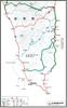
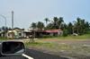
旭海 Xuhai - Nantian 南田
Taitung 台東
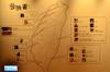
Taitung County 台東縣 also known as Hou Shan 後山 by many of the locals, is the 3rd largest county on Taiwan with a 230 km coastline. Taitung was the last part of the island to be colonized by Han Chinese immigrants late in the 19th century and remains sparsely populated with a population of 250,000 today. Taitung County is home to Bunun, Paiwan, Rukai, Amis, Beinan, Yamis and Gamalan aborigines. The county also includes Green Island and Orchid Island. Orchid Island is home of the Tao people (Taiwanese aborigines closely related to the people of the northern Philippines) and has become a popular tourist attraction despite the government-operated Taiwan Power Company's nuclear waste dump on the island.
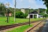
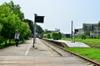
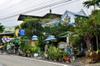
Taitung Railway Art Village 鐵花路
After the railway was moved out of the city in 2001, the city converted the station and length of the railway through the city into a park, Taitung Railway Art Village 台東鐵道藝術村.
Dongyuan 東源
Xuhai 旭海
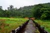
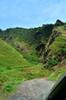
A-lang-yi Trail 阿朗壹古道
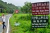
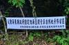
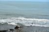
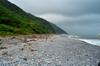
The 8-kilometer A-lang-yi trail follows the last island's last remaining section of of coastline without paved roads and concrete wave breakers. Before it's establishment in Qing dynasty, the trail was the conencting path between Xuhai 旭海 village in Pingtung county and Anshuo village in 安朔 Taitung county. The Ministry of Transportation and Communications has long sought to connect in this last section of missing coastal road which would reduce travel time between Kenting and Taitung by 40 minutes. Environmentalists that the road would cut out wildlife's connection between the land and ocean.
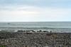
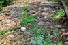
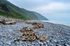
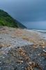
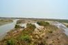
This stretch of beach known for its many round, flat rocks

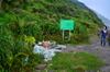
Accusations of "fake" environmental groups and falsehoods
A jeep passes us to venture out onto the smooth rock area, probably to pick up driftwood
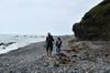
We give up on driving and start walking to the Green See Turtle nesting area
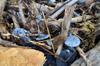
Some garbage, but not nearly as much as other coastal areas
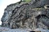
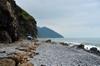
Convoluted rock forms
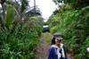
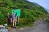
Ah-Tse, Eagle's joyfully calm companion, walking down the access road that cuts through the forest
The beach can be seen through the strip of coastal forest

Taiwan Hai Tong
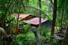
An occupied and cultivated area in the forest not far from the beach

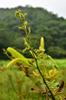
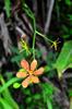
Lintou, a native plant in the same family as the pineapple
Remnants of cultivation
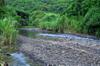
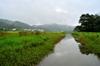
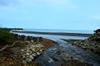
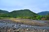
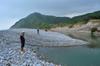
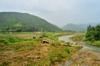
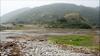
River leading out of the mountains to the sea
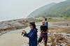
The river is deep in some places after the typhoon, but we find a shallow flat area to cross
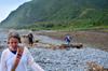
Walking on curved stones is challenging

the ocean
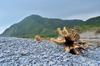
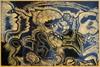
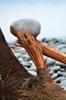
Nature's works of art
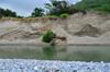
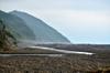
Eroded sand dunes
the beach and softer sand is disappearing
Previously all a sandy beach area
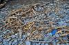
Stones mingle with driftwood debris

Checking out natures carving
Naturally poised rock
Final stretch of beach before the turtle nesting area
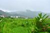
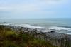
Tropical coastal landscape
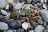
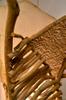
Small iridenscent lobster thrown up during the storm
Beach and forest near nesting area
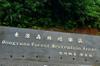
Area along the coast where the turtles have been known to nest
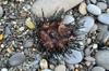
Urchin, also tossed up in the storm
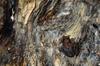
Small frog on the beach among the driftwood
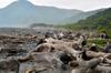
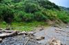
Driftwood clogs the beach, probably preventing the turtles from coming ashore
Conservation rules, and piles of collected, but not cleared trash
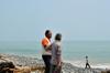
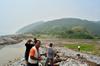
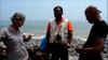
Philip and Eagle investigate
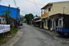
Nantian 南田

We meet one of the main Paiwan clans of Nantian Village.
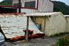
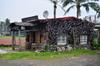
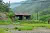
Housing quality in the area is extremely uneven. This is one of the better places, where we saw goats
Another nice looking place, supposedly a guest house
Paules' studio, above and behind which she is building a larger, airier structure with rooftop use

Tammy, Paules, and a younger brother
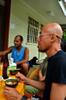
Eagle in foreground, Paules' son behind

KB or something like that. Had just roled in some dead animal to make himself more attractive

Paules, her younger brother (middle) and older brother (right)
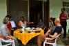
The clans decisionmakers including Paules' older brother (village chief, pointing) and mother to the right of him

Church and truncated bridge to road from expansion
Village chief and Paules' son

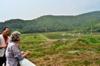
Nearby coastline seen from lookout point above the main village area

Coastline, looking back toward main village area
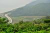
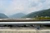
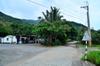
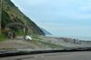
Highway 26 and nearby marine fisheries

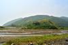
the relocation of Nantian village
Previous village location further south along Highway 26
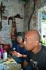
Some heart-to-heart with the village chief
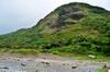
A small alluvial plain that feeds into the ocean
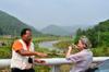
the village chief tells me about how the current community of Nantian was formed

End of Highway 26, beginning of A-Lang-Yi Historic Trail
Another wide, seasonally flooding river feeds into the ocean at the beginning of the trail
Talk about nuclear waste
Eagle and Ah-tse take in the view
Tough times for the village chief, damned if you do/don't
the gap in the road between Pingtung and Taitung counties
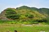
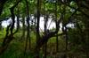
Coastal vegetation (revegetations?)
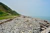
this stretch of beach is famous for its stones
discussing energy

As gentle beaches are lost to changing current patterns and more intense rain events, the coastline forest has declined.
Back to the village for a rest before heading back to Taitung

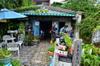
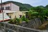
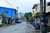
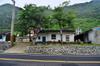
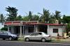
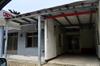
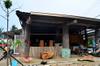
Buildings in the area
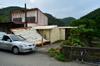
Where we stayed at the older brother's house

The half-bridge
Heading out of town - also a place owned by the older brother
A sister-in-law of Paules runs this karoake restaurant seemingly popular with the locals
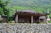
Traditional structure built with public money on private land that we might be able to use for future projects
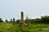
Attempts to "beautify" the area with the goal of?
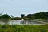
Marine fish pond
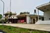
Local township office with government /police administrative functions
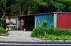
A simple but attractive place
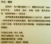
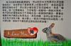
In 2009 the Ministry of Economic Affairs identified Taitung County’s Daren Township (達仁) as the target site for storing low-radiation nuclear waste. The selected county and township governments where the site is located would receive a NT$5 billion (US$146 million) “Friendly Neighbor” payment from Taiwan Power Co as compensation. Nantian Village (南田), Paiwan Village Chief Chang Chih-hsin (張志信) said that more than 60 percent of the villagers supported the plan because of the compensation and employment opportunities promised by Taipower.
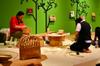
National Museum of Prehistory 國立臺灣史前文化博物館