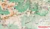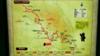

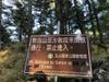
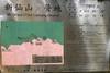
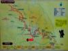
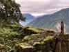
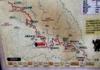
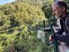
Six day hike along the southern edge of Yushan National Park 玉山國家公園 in southern Taiwan from Xiangyang trailhead 向陽登山囗 at the highest point currently open on the Southern Cross-Island Highway, following the South Second Section hiking route 南二段 along the Central Mountain Range 中央山脈 toward Mt. Jade 玉山 (Yushan), then turning off southward toward Xinkang mountain 新康山 after Jiaming Lake 嘉明湖 then dropping down toward the north to connect with the Batongguan Trail 八通關古道 to walk out to Nanan trailhead 南安登山口 near Yuli 玉里 on the east coast. We are lucky that two nearby typhoons turn away from the island and even bring us good weather by pulling away humidity.
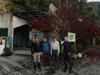
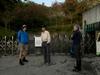
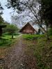
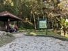
The day before we start walking, we catch a morning express train from Taipei to Guanshan 關山. After lunch in Guanshan, we catch the 8178 bus 鼎東客運 to Lidao 利稻. After an hour climb on the South Cross Island highway 臺20線 南橫公路 we arrive at the Bunun village of Lidao 利稻 where we will send the night. The quiet village of Lidao seems dominated by businesses servicing mountaineers. At just above 1000 m elevation and about half way to the Xiangyang trailhead 向陽登山囗, staying in Lidao is a compromise to camping at the trailhead; we get some altitude acclimatization and can get started faster not breaking camp. We spend the night at Xile B&B 喜樂民宿 which arranges a 4:30 AM shuttle so we can meet our porter at the trailhead at 5:30 AM. We find a place for an early dinner in the village and walk back to our B&B in cold light rain. The B&B has been in operation for a long time and has many historical photos on the wall.
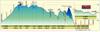
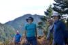
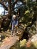
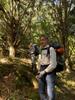
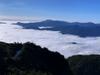
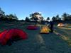
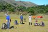
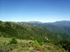
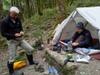
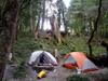
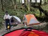
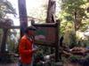
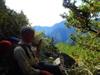
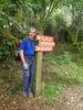
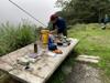
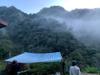
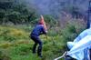
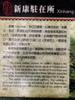
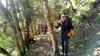
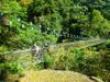
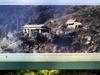
Before dawn, we take a shuttle operated through our hostel from Lidao 利稻 to the Xiangyang trailhead 向陽登山囗 to meet our porter at trail head at 5:30 AM. It is still raining lightly in the morning but as we climb from 1000 m to the trailhead at 2300 m we climb through the clouds into a clear and dryer morning. Over the course of the one hour drive we learn that our driver is also a porter and he shares information about our route, especially about water availability. Our plan is to complete the steep climb to Jiaming lake hut 嘉明湖山屋 after hiking 8 km by lunchtime where we will collect the supplies (about 35 kg) carried up by our porter and push on to the next camp to get away from the crowds up for day hikes around the popular Jiaming lake. With promising weather, we push on toward the next camp site with water, Buxin 布新營地 giving us a total hiking distance of 16.5 k for the day.


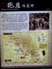
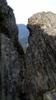
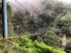
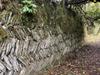
The 209 km long Southern Cross-Island Highway 南橫公路 (nán héng gōng lù) or Highway 20, links Tainan City 台南市 (tái nán shì) on the west coast to Taitung City 臺東市 (tái dōng shì) on the east coast over the southern part of the central mountain range along Taiwan's spine. The road follows a path of the indigenous Bunun people. During Japanese rule the path was widened to allow better governing of the indigenous population in the mountains. After Japan left, the path was widened into the Southern Cross-Island Highway 南橫公路 (nán héng gōng lù) from 1968 through 1972. Higher sections of the road were not surfaced until 1992. The highway was closed in 2009 when torrential rains brought by typhoon Morakot caused landslides washing away large sections of the road. Landslides buried the east entrance of the Daguanshan Tunnel 大關山隧道 (dà guān shān suì dào) and destroyed 300 m of the road. The rock around 埡口 (yà kǒu) at the pass is primarily stratums composed of argillite, shale, and slate and phyllite. The layered parallel planes render a fragile structure prone to slides and present a challenging environment on which to maintain a road. The road seems to be constantly in repairs somewhere along its length. The section of the highway from Meishan 梅山 (méi shān) on the west side through Xiangyang 向陽 (xiàng yáng) on the east side has been closed since Typhoon Morakot. The highest point of the road is at 2722 m at Yakou 埡口 (yà kǒu), Guanshan Pass 關山埡口 (guān shān yà kǒu) or Daguanshan Pass 大關山埡口 (dà guān shān yà kǒu).


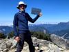
The hike up to Jiaming Lake Cabin 嘉明湖山屋 takes us up 1000 m over 7.9 km in under six hours.
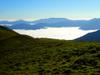
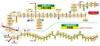
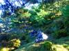
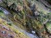
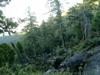
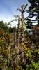
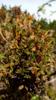
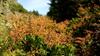
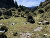
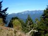
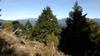
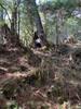
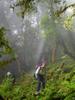
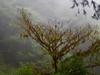
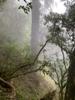
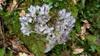
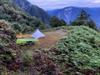
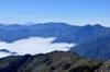
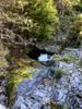
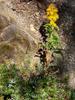
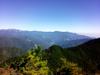
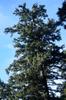
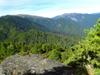
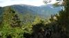
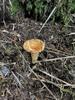
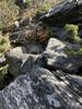
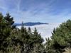
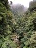
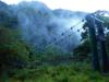
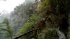
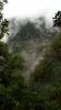
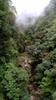
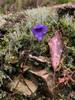
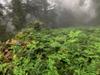
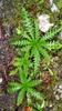
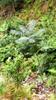
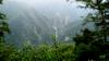
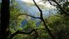
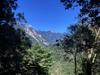
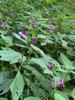
At Taiwan's near tropical latitude the tree line climbs to about 3600 m. The alpine grasslands zone, above 3600 m may get up to 2800 mm of rain annually with an annual average temperature below 5 C. The metamorphic rocks of Taiwan's eastern central range are represented by an assemblage of metasedimentary and metavolcanic rocks composed largely of schists and metamorphosed limestone. Active geology leaves a thin layer of rapidly eroding crumbly rock which tends to continue downward along the steep slopes. Mosses and lichens mark pockets of nutrition where perennial grasses and sedges may establish on thin layer of dry crumbling bedrock soil exposed to low temperatures, dryness, ultraviolet radiation, wind, drought and a short growing season. Common plants here are low dry shrubs and herbs, including
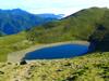
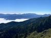
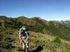
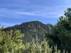
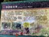
After Jiaming Lake 嘉明湖, we keave the Central Mountain Range 中央山脈 and main South Second Section hiking route 南二段 to continue east along the Sinkang range 新康山列
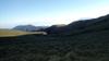


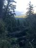
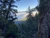
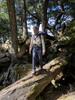
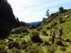
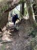
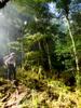
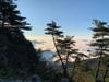
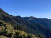
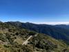
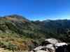
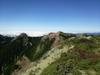
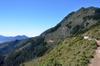
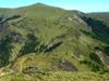
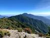
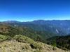
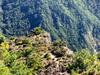
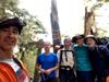
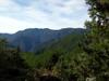
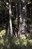
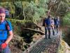
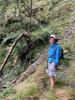
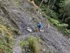
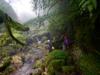
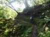
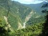
We made good time our first day, getting beyond the Jiaming tourists. We are now focused on getting good camp sites with water to get positioned to climb Sinkang Mountain 新康山. On our second day we walk 13.9 km climbing 777 m and dropping 1372 m continuing to follow the Lianli 連理 ridge eastward toward Sinkang mountain 新康山 along the southern edge of Yushan National Park 玉山國家公園.

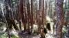
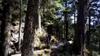
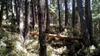
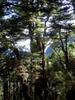
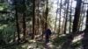
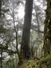
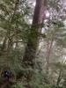
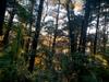
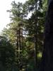
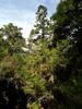
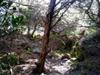
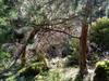
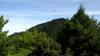
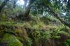
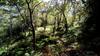
Coming under the tree line the sparse woodland dominated by firs holds more soil than the higher tundra grasslands. Firs (Abies) are a genus of 48–56 species of evergreen coniferous trees in the family Pinaceae. Firs are most closely related to the genus Cedrus (cedar). Located between 3,100m and 3,600m, this zone is dry and cold in winter, with an annual average temperature between 5 and 8°C. Vegetation thrives on sun facing slopes but may be dwarfed and lean leeward where there are few larger trees. The forest is dominated by Taiwan White Fir with and an understory of junipers and dwarf bamboo.
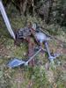
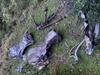
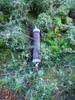

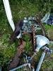
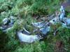
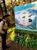
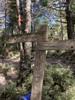
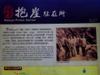
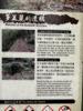
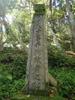
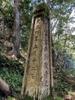
On the 10th of September 1945 two American military planes took off from Okinawa on route to Manila. These converted B-24 Liberator bombers, carrying liberated allied prisoners of war, ran into the tail end of a typhoon. The 'Les Miserables' crashed into the sea; the 'Liquidator' (Serial Number 44-42052) crashed in the mountains of Southern Taiwan. The 5 crew, 11 American POWs, 4 Dutch POWs, and 5 Australian POWs all perished. The crash was witnessed by local hunters and a recovery mission, which included Japanese military, local Taiwanese, and native tribes, was undertaken shortly afterwards. A second recovery team was caught in a subsequent typhoon, and 26 members of the team died. A third team was sent up in October, 1945, to bury the bodies near the crash site. A further mission several years later, recovered the bodies for reburial in Hong Kong - Sai Wan War Cemetery, and the US - Jefferson Barracks National Cemetery. (Thanks To Richard Foster and Michael Turton)

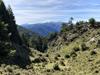
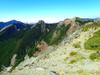
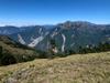
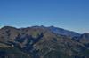
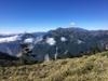
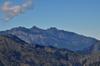
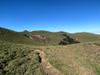
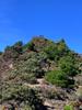
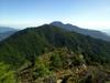
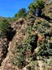
Our third day we have a short 6.7 km walk climbing 985 m and dropping 633 m to Xinxian Mountain 新仙山 where we plan to arrive early enough to summit Xinkang mountain 新康山 with day packs form our base camp. Our route continues to follow the Sinkang ridge 新康山列 staying in the range from 2700 to 3000m.


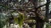


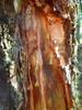
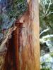


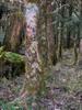
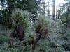
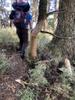
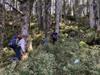
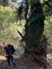
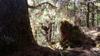
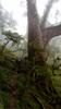
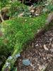
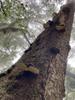
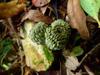
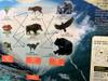
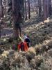
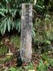
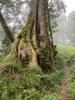
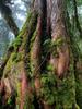
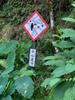
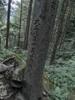
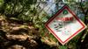
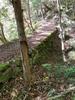
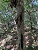
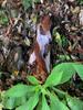
We noticed a pattern of debarking of the bottom 1.5 meters of many trees. Our first thought was that it might be bears, but later realized it must be deer. Increased debarking by deer may indicate overabundant deer population. The sambar deer 水鹿 (shuǐ lù) Rusa unicolor population in Taiwan has expanded rapidly in the last 20 years, and its debarking behavior has been observed for approximately 10 years, especially in Yushan National Park. Sambar show a preference for Pinaceae except Taiwan red pine 台灣二葉松 (tái wān èr yè sōng) Pinus taiwanensis. Trees with a diameter around 20 cm were most preferred by sambar for debarking.
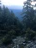
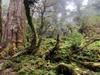
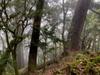
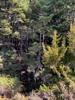
The Upper montane 山地上層帶 Tsuga-Picea zone 鐵杉冷杉林帶 ranges from 2,500 to 3,100 m, has an average annual temperature of between 8 and 11°C, and annual rainfall of 3,000 to 3,500 mm. Juniper and dwarf bamboo continue to dominate the ground cover.


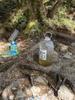
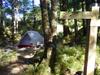
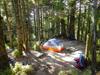
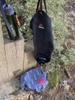
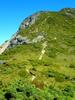
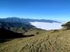
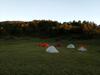
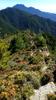
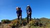
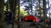
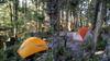
We arrive early at our base camp at the base of Xinkang mountain 新康山 but we are unable to properly filter the water from nearby ponds so cannot safely ascend the exposed mountain peak and need to save our water for the long descent the next day.


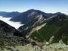
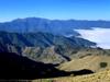
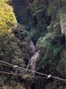
On our fourth day, we drop 1597 m and climb 212 m over 7.1 km from the our campsite on the Sinkang ridge 新康山列, dropping from an altitude of 2700 m to 1650 m.
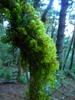
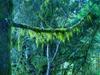
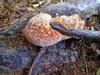
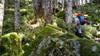
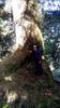
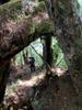
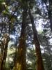
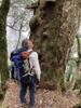
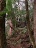
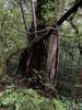
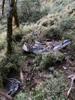
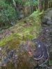
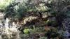
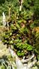
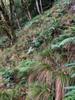
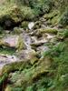
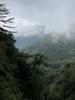
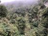
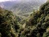
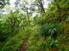
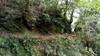
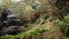
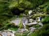
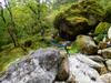
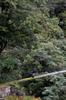
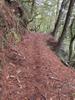
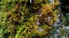
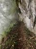
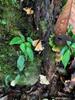
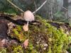
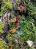
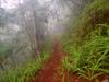
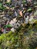
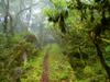
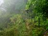
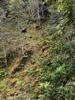
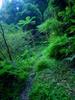
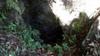
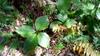
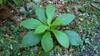
Between 1,500 and 2,500 m elevation, the Montane Quercus zone has annual average temperature of between 11 and 17°C, high annual rainfall of 3,000 to 4,200 mm and high humidity. Fagaceae plants are the major species found here, and Quercus is the dominant tree species. The top layer of the Quercus zone at 2,000 to 2,500m altitude is in thick clouds and fog with forests of Taiwan Cypress. The lower layer includes Cryptomeria-like Taiwania, Taiwan yellow cypress, Green Maple. As we descend through this zone, we notice the understory more occluded from sunlight, the mat of dwarf bamboo disappears. The ground and tree branches are covered in lichen and mosses and the understory brush becomes dominated by ferns and bracken.
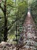
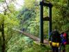
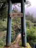
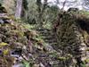
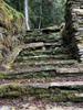
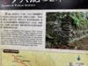
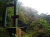
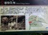
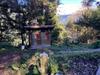
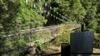
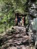
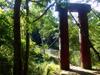
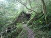
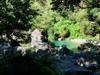
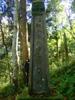
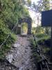
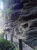
The Batongguan Trail 八通關古道 lies within Yushan National Park 玉山國家公園. It was one of the three cross island roads during the Qing Dynasty. Pattonkan was the name given to Jade mountain by the Tsou indigenous people. The 152 km connects Zhoushan 竹山鄉 in Nantou 南投 to Yuli 玉里鎮 in Hualien county 花蓮. The road was built during Chinese Qing Dynasty occupation of Taiwan to facilitate control of the indigenous natives and to defend against Japanese attacks. During the Japanese occupation, the Japanese used the road to manage the eastern side of the island Taiwan building out the section continuing to Yuli 玉里.


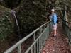
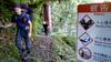
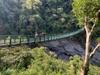
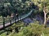
Two separate groups hike back up the Batongguan trail early in the morning before we continue our hike down to Walami.
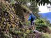
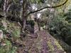

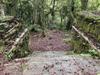


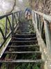


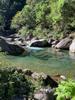
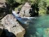
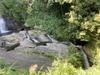
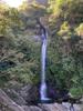
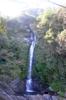
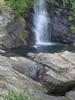
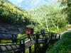
After short morning walks up the Batongguan trail we return to camp and pack up after breakfast. The hike from Baoya to Walami is 12.8 km, climbing 945 m and dropping 1587 m.


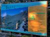
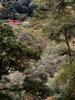
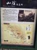
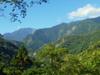
Yushan National Park 玉山國家公園 located over the southern central mountains with an area of over 1000 km2 is the largest national park of Taiwan. The park is named for Mount Jade, the highest peak in East Asia at 3,952 metres. The first three national parks in Taiwan were etablished in 1937 under Japanese rule, including Nītaka-Arisan National Park 新高阿里山國立公園 which would later become Yushan National Park and Alishan National Scenic Area 阿里山國家風景區. The current Yushan National Park 玉山國家公園 was etablished in 1985 by the KMT government. The nine national parks of Taiwan, under the administration of the Ministry of the Interior, cover 7,489.49 square kilometres or about 8.6% of the entire land area of the country. Two-thirds of Yushan National Park is above 2,000 metres.


On our last day we walk out of the park after 13.1 km, climbing 698 m and dropping 1287 m.
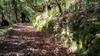
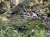
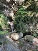


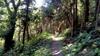

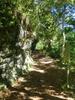

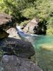
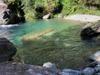


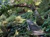
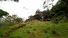
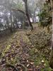
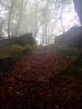
The Lowland Machilus-Castanopsis forest 楠櫧林帶 between 500 to 1,500 m enjoys warm and humid weather with an annual average temperature of 17 to 23°C and humus-enriched soil. Evergreen broader-leaved trees are the major species, and most plants belong to the Machilus, Lauraceae and Fagaceae species. Ground plants are also plentiful including ferns and bracken.


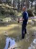
A 20 minute cab ride gets us to the Yuli train station where we catch an express train back to Taipei.