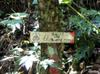
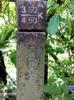
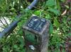
sign

journal > keywords > sign: 2023 | 2020 | 2019 | 2018 | 2017 | 2016 | 2015 | 2014 | 2013 | 2012 | 2010 | 2009 | 2008 | 2007 | 2005 | 2004


2023

IMG_20231010_083953_4
Longleaf Flatwoods Reserve

2020

IMG_20200215_072816_0
Monkey Mountain ridge 猴山岳 or Paozilun 炮子崙 trail
IMG_20200101_153144_6
road improvement in Quchi 屈尺

2019

IMG_20191208_075931_6
IMG_20191208_075852_7
Taipower gate at trail head
IMG_20191208_075752_1
IMG_20191005_094935_3
to Smangus 司馬庫斯
IMG_20190922_070839_4
the new bikeway is also closed during typhoons
IMG_20190922_070758_1
The new Qingtan 青潭 bikeway and when it is closed due to high water levels
IMG_20190914_113004_2
be responsible
P9140344
John
P9130300
Qanituan 加年端 Jianianduan
P9130277
Sanfensuo 三分所
IMG_20190913_135230_9
Sanfensuo station 三分所
IMG_20190913_130625_0
trail up to power pylon
IMG_20190913_102001_5
tunnel 丹大林道隧道
IMG_20190913_100027_2
Danda Suspension Bridge 丹大吊橋
IMG_20190817_133843_9
Nanao trail 南澳古道
DSC_2151
Sustainability Studio
IMG_20190608_093335_6
No bungee jumping off of Dahan bridge 大漢喬 over Daman stream 大曼溪
IMG_20190316_134327_3
Beginning of road 42 in Shuangxi 雙溪
IMG_20190316_123601_8
Shifen 十分
IMG_20190316_082501_9
narrow Pingxi 平溪 street
IMG_20190316_074424_9
Guangming 光明 road to Nangang 南港
IMG_20190316_073512_7
P_20190302_155958
Bunun signs
IMG_20190228_094750_1
end of road 16
IMG_20190207_165705_0
Nanao trail 南澳古道
IMG_20190207_164743_0
Map of original Atayal villages
IMG_20190207_161005_5
Frogs
IMG_20190207_153825_6
Nanao trail 南澳古道
IMG_20190207_145750_3
Nanzi Police Station 楠梓警官駐在所
IMG_20190205_170351_8
first night's camp site
IMAG5234
IMAG5233
IMAG5231
IMAG5225
A sign about historical markers from the Japanese era
IMAG5212
IMAG5211
IMAG5201
Watch for snakes and wasps
IMAG5200
No collecting specimens!
IMAG5198
The many former Atayal villages along the Nanao trail

2018

IMG_20181222_115741_9
IMG_20181222_115720_1
Turn off to Hapen
IMG_20181222_115715_0
IMG_20181222_110924_2
IMG_20181202_152519_7
out of the trail to the road
IMG_20181202_133618_8
side trail to Hongludishan 烘爐地山
IMG_20181201_154812_0
Tongho trail 桶後越嶺古道
IMAG4666
good message that is often overlooked
IMG_20181201_114828_1
landslides all along the road
IMG_20181201_114311_7
Taipei water source
46880984_1494233580721007_3873192127324225536_o
Fushan Village
46712838_1494233564054342_7660073837408550912_o
Hapen Trail
DSC_1297
TongHo 桶后 at 13k on Tongho Road 桶後林道
DSC_1294
path closed due to typhoon damage
DSC_1293
crossover trail to the coast
42791052_10155367919942493_8124368447875317760_n
Tongho Road 桶後林道
GOPR2993
Houtong Station 猴硐
GOPR2979
Xiaocukeng trail 小粗坑古道
GOPR2970
Xiaocukeng trail 小粗坑古道
GOPR2960
turn off toward Houtong 猴硐
GOPR2953
Xiaocukeng trail 小粗坑古道
20180714_135928
20180714_110517
DSC_1136
distance to emergency shelters
DSC_1135
rainfall road - closing criteria
IMG_2210
house number of the abandoned house at fish pond on stream
P6300308
The story of Sayun
P6300297
Nanao trail 南澳古道
20180604_070236
mountain permit required
20180604_070137
Babokula mountain trail 巴博庫魯山徑
IMAG2615
IMAG2607
IMAG2593
Wushan trail 鳥山古道 to Zhuzi mtn 竹子山
GOPR2823
Wantan trail 灣潭古道
IMAG2560
Wantan trail 灣潭古道
IMAG2557
Wantan trail 灣潭古道
IMAG2555
IMAG0287
to Taipower Bihai hydroelectric power plant 台電碧海發電廠
IMAG0280
beginning of the Heping forest road 和平林道 or Dazhuoshui forest road 大濁水林道
P_20180427_185429
Friday train to Xincheng 新城
20180422_100228
20180422_080758
Fish protected in the Wulu River 霧鹿溪
DSC_0974
Monkey Mountain ridge trail 猴山岳登山步道
DSC_0973
Monkey Mountain ridge trail 猴山岳登山步道
DSC_0962
Monkey Mountain ridge 猴山岳 or Paozilun 炮子崙 trail
DSC_0902
Yunu Waterfall 乙女瀑布
DSC_0896
Lele Police Station 樂樂駐在所
DSC_0895
Lele Police Station 樂樂駐在所
DSC_0892
Ecological Area entry permits required
DSC_0891
Mabloasih trail 馬博橫段
DSC_0890
Yunlong Waterfall 雲龍瀑布
DSC_0879
Lelegu Hot Springs 樂樂谷溫泉 trail is closed
DSC_0869
in Dongpu 東埔
20180318_145917
privately used national land
20180318_145447
trailhead to Xiangtianhu 向天湖
20180304_102835
20180224_085336
work rules
20180224_085330
typhoon Soudelour road repairs
20180224_085307
typhoon Soudelour road repairs
IMAG1730
IMAG1729
IMAG1723
Red paint indicates forestry claim of wood
IMAG1698
Bruce and Philip at the turn off to Jialuohu 加羅湖
20180215_083003
20180114_130530
IMG_0180
IMG_0179
IMAG1514
Nanmu
IMAG1513
Elaeocarpus
IMAG1505
IMG_20180113_143502
IMAG1501
DSC_0684
Ershawan Fort 二沙灣砲臺
IMG_20180110_140757
Lion's head mountain 獅仔頭山
IMG_20180110_125828
Jungle Camp of Kukutsu

2017

20171222_074137
crossing the highway
IMAG1465
IMAG1419
IMAG1412
IMAG1411
IMAG1410
IMAG1406
IMAG1395
IMAG1394
IMAG1016
New Shop Creek!
IMAG1014
terraforming
IMAG1013
IMAG1008
Character culture
IMAG0975
Taipower Guishan Hydroelectric Plant 台灣電力公司桂山發電廠
20170907_065300
Taipower Guishan Hydroelectric Plant 台灣電力公司桂山發電廠
20170711_090130
False start on the 47-1
IMAG0331
turn up Laoquan street lane 45 老泉街45巷
IMAG0316
Nanao Farms 南澳農場
IMAG0295
road improvements
IMAG0283
provincial government jurisdiction
IMAG0278
to Aohua Waterfall 澳花瀑布
IMAG0272
wash off your truck
IMAG0246
turn toward Aohua 澳花 before the Dazhuoshui river 大濁水溪
DSC_0413
Beishi stream trail 北勢溪古道
DSC_0406
no swimming in any Pinglin rivers except from June through September in certain streams
DSC_0383
45 minutes back to the suspension bridge
DSC_0371
Beishi stream trail 北勢溪越嶺古道
GOPR2226
Toward Lulu hot springs 轆轆溫泉
GOPR2222
fish protected in the Xinwulu river 新武呂溪 watershed
GOPR2208
leaving the highway, permits required
GOPR2202
"Six Pits Hot Spring" 六口溫泉
IMG_8751
IMG_8750
IMG_8747
DSC_0339
frog research, don't disturb
DSC00088
Sykaro trail 霞喀羅古道
DSC00087
road work
DSC00086
Sia Shanben
DSC_0243
Kolas Yotaka
IMAG0027
work on Wulai hot springs 烏來溫泉
DSC00116
Side trails in Huisun Forest Area 惠蓀林場
DSC00114
area amenities
DSC00113
research area
DSC_0134
DSC_0133
DSC_0126
road closed due to damage from typhoon Soudelour
DSC_0125
quota and control policy
DSC_0124
road closed
DSC_0119
closed due to heavy damage
IMG_8284
IMG_8277
don't feed the strays
DSC_8273
Zhang Xueliang memorial area
DSC_0003

2016

IMG_3203
Aboriginal Volunteer Army Memorial
GOPR1948
Japanese Shinto Dawu shrine ruins
GOPR1941
GOPR1929
Kuaigu hut 檜谷山莊
GOPR1926
at Kuaigu hut 檜谷山莊 turn off
DSC_9731
貓空尖 562 m
DSC_9715
DSC_9688
Ejiaoge Shan 鵝角格山 475m
DSC_9687
樟湖步道 Zhanghu Trail
DSC_9686
DSC_9683
木柵貓空樟湖步道 Zhanghu trail head
DSC00096
trail closed
DSC00092
bus to trailhead
DSC00084
DSC_9611
DSC_9583
Xicun 西村
DSC_9580
IMG_2176
Wuling Quadruple Trail
IMG_2175
Wuling Quadruple Mountains
IMG_2174
IMG_2132
Dwarf bamboo (arrow bamboo) 箭竹 (jiànzhú) Sasa senanensis
DSC00090
IMG_2129
trails, creeks and cabins
IMG_2128
Xinda pond and Bashalayun cabin
IMG_3115
新達山屋 Xinda Hut
IMG_3113
IMG_2100
holy mountain
IMG_2096
7 AM
GOPR1852
the way we came
DSC_4378
DSC_4347
crossroads
IMG_2014
Dabajian trail
IMG_2004
Dongsian Waterfall 東線瀑布
DSC_4295
dangerous road
IMG_1999
The Syakaro and Luchang Historic Trail 霞喀羅與鹿場連嶺古道
IMG_1997
walking distances
IMG_1996
hike map and climb
IMG_1995
Important Notices
IMG_1994
Dabajian Mountain Trailhead
IMG_1991
The ice ages in Taiwan
IMG_1990
Guanwu's forests
DSC_9423
DSC_9396
trail to Zhushan 竹山
DSC_9365
to Wushan 烏山 and Zhushan 竹山 mountains
DSC_9346
DSC_9340
DSC_9334
DSC_9332
DSC_9249
hives and their products
DSC_9248
hive diseases and predators
DSC_9247
The hives and their inhabitants
DSC_9246
Bee keepers and hives
DSC_9245
About hives and apiculture
DSC_9244
About hives
DSC_9243
All wild bees are welcome at the bee hotel
DSC_9242
Wild bee hotel
DSC_9241
Wild bee hotel
DSC_9236
Monkey's medicine
DSC_9227
DSC_9163
history of le Jardin de Cluny
DSC_9161
history of le Jardin de Cluny
DSC_9148
Medicinal ground cover plants
DSC_9146
The forest of the unicorn
DSC_9143
le jardin médiéval du musée de Cluny
DSC_9140
DSC_8970
DSC_8969
DSC_8776
DSC_8775
DSC_8702
Saint-Jean-Baptiste
DSC_8694
Montée du Barda
DSC_8606
DSC_1039
Les gorges de l'Ardèche
DSC_7958
Areas of the compound
DSC_8549
DSC_8546
Orientation
DSC_8505
DSC_8487
Col de la Bataille, 1313m
DSC_0825
Plateau d'Ambel
IMAG0107
Garden City services
IMAG0106
dangerous stuff on the road
DSC00031
to the coastal road
DSC00021
DSC_7880
entire watershed closed to fishing
DSC_7744
DSC00037
to 加羅湖
DSC00026
road closed
IMG_2151
SiJi Forest Road 四季林道 trail head
DSC00052
Highway 9, 北宜公路
DSC00050
descent back to Xindian 新店
DSC00044
road into the reservoir?
DSC00042
ErGeTou, 9 toward Pinglin 坪林
DSC00028
waiting for Bruce, Peter and Jack
DSC00025
DSC00022
on the 106 toward 平溪
DSC_7620
DSC_7612
DSC_7611
DSC_7609
DSC_7608
contractor failure
DSC_7607
DSC_7605
DSC_7600
DSC_7548
DSC_7538
DSC_7532
DSC_7528
DSC_7526
The peak
DSC_7502
DSC_7501
DSC_7496
Lion's head mountain is a historic site
DSC_7484
DSC_7483
Xindian felwort 新店當藥 (xīndiàn dāng yào) Swertia shintenensis Hayata
DSC_7482
DSC_7479
Kukutsu internment camp memorial
DSC_7415
trail to Xiaocukeng 小粗坑
DSC_7385
Trail flag
DSC_7309
path to XiaoWuLai 小烏來
DSC_7262
20 mins to BeiCha, 20m higher
DSC_7258
trail to 南插天山
DSC_7206
lower trail toward XiaoWuLai 小烏來
DSC_7195
15 mins to Dongyanshan 東眼山 trail
DSC_7191
trail to DongYanShan 東眼山

2015

DSC_6877
Dabajian mountain 大霸尖山
DSC_6876
Taoshan 桃山
DSC_6622
DSC00147
tea research
DSC_6289
DSC_6182
the road is closed at night
DSC00139
segments of the walk from Tonghou 桶後 over to Jiaoxi 礁溪
DSC00122
experiment in progress
DSC00103
卡拉莫基山 Kalamoji mtn; 波露山陵線 Bolu mtn ridge
DSC00068
trail sign
DSC00058
experiment in progress
DSC00027
sign to bottom of Xiluoan Rd 西羅岸路 and Honghegu 紅河谷
DSC_5271
don't abandon dogs in the water shed
DSC_4198
land for sale
DSC_4895
Outdoor adventure and ecotours place
DSC_4885
Deer farm
DSC_4884
The don't develop on slopeland sign
DSC_4717
Don't wear perfume!
DSC_4716
Watch out
DSC_4714
Forestry bureau administrative demarcation sign
DSC00011
Host address

2014

IMG_4767
Information about the local area
DSC00009
2.5k
DSC_3776
Atayal origins
DSC_3775
Local plants in Atayal
DSC_3774
local animals in Atayal
DSC_3773
Atayal iconography
DSC_3755
turn off to 茶墾山 (chá kěn shān) and 模故山 (mó gù shān)
DSC_3750
DSC_3749
保安林界
DSC_3691
turn off to 茶墾山 and 模故山 with 1 hr of light left
DSC_3688
trail to 札孔山 and 李茂岸山
DSC_3684
the Fu-Ba trail 福巴越嶺步道 is closed due to damage from typhoon Matmo 麥德姆颱風
DSC_3532
Don't pick the private bamboo!

2013

DSC_9546
Chinese hemlock 台灣鐵杉 (táiwān tiě shān) Tsuga chinensis
DSC_9504
negative ions and 芬多精 (phytoncides)
DSC_9483
Taiwan stranvaesia 玉山假沙梨 (yùshān jiǎ shālí) Photinia niitakayamensis
DSC_9477
Taiwan white pine 台灣五針松 (táiwān wǔ zhēn sōng) Pinus morrisonicola
DSC_9474
DSC_9469
Nenggao wildlife
DSC_9443
The Birds of Nenggao Area
DSC_9392
DSC_9391
DSC_9387
Yunhai 雲海
DSC_9386
DSC_9385
History of the Yunhai line station 雲海保線所
DSC_9331
Plant formation of laurel and oak forests
DSC_9316
Forest variety along the Nenggao trail

2012

DSC_0227
Designated conservation area sign

2010

DSC_8587
from Cingtiangang 擎天崗 toward Pingdengli 平等里
DSC_8575
watch for mad cow
DSC_8562
toward Cingtiangang 擎天崗
DSC_8561
Mt. Huangsui Ecological Conservation Zone
DSC_8254
DSC_8252
sign
DSC_8249
DSC_8178
Mike at a crossroads
DSC_8172
Philip and Mike recirculating
DSC_8133
Wuling Quadruple Trail
DSC_8132
Wuling Quadruple Mountains 武陵四秀
DSC_8131
3.5k to the Taoshan 桃山 trailhead camp site

2009

17519
AnBaoJian Mtn 暗寶劍山 680m
DSC_4528
triangulation pillar?
DSC_4527
Jiajiu 加九 ridge east saddle
DSC_4523
30 mins back up to the saddle and 150 minutes down to Red River canyon
DSC_4522
at the cut-off up toward Xiang Tianhu 向天湖
14432
Lapu Mtn 拉璞山
14429
sign
14426
sign
DSC_4073
cut-off north to Wulai mountain 烏來山

2008

DSC_0463
side trail down to the stream bed (we don't take)
DSC_0414
369 cabin 三六九山莊
DSC_0389
DSC_0362
Cika cabin 七卡山莊 is located at the site of traditional Atayal hunting ground
DSC_0361
Cika cabin 七卡山莊 has water and can sleep 130
DSC_0199

2007

DSC_9185
DSC_9183
DSC_4905
DSC_4830
DSC_4807
DSC_4806
DSC_4801
DSC_4798
DSC_4795
DSC_4794
DSC_4793

2005

DSCN0822
waiting for enforced quota of 100 cars
DSCN0820
Neidong Forest Road 內洞林道 entrance, behind the police station
DSCN0542
no poisoning, electrocuting or netting fish...
DSCN0205
Taipei pot plant auction
DSCN0052
endangered butterflies in the Xuanyuan 萱源 area
DSCN5964
DSCN5893
hiking trails off the highway
DSCN5881
DSCN5815
Entering Taroko National Park (太魯閣國家公園) on the East Coast highway
DSCN5597
5477
5446

2004

DSCN4849
Liugongjun 瑠公圳 canal memorial
DSCN2928
to Tamanshan (2130m)
DSCN2920
LaLaShan 拉拉山 (80 mins)
DSCN2894
KwaiShan 檜山 turn off
DSCN2890
DSCN2876
to WuGuShan 勿古山 (1457m)
DSCN2875
walking times
DSCN2869
ChaTian Preserve 插天山自然保留區
DSCN2866
Safety
DSCN2863
Where do you get the permit?
Browse by: Years | Keywords | Locations | People