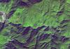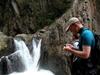

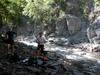
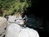
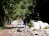
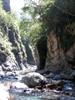
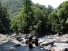
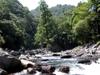
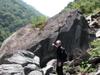
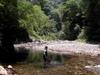
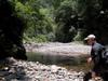
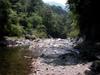
We meet at New Garden City 花園新城 in Xindian 新店 leaving by 7:30 AM. We park at the end of the upper road above (east of) Fushan 福山 so we can hike further up the valley where the river will be reasonably navigable. We walk east under overcast weather in lush second growth forest on the Hapen trail 哈盆越嶺. The forest is wet and the trail sometimes muddy from the past week's daily downpours. At 10:00 we drop down to the river. Kitty and Tammy walk back on the trail. Bruce, Jack and Philip head down the river. We are back to the car before 4:00
| 1 | 9:00 AM | 303633 | 2740824 | On trail at top of large landslide |
| 2 | 9:02 AM | 303624 | 2740781 | Turn-off to weather station |
| 3 | 9:59 AM | 304493 | 2740395 | Down to river |
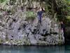
| 4 | 12:20 PM | 303968 | 2740245 | Deep pool in bend |
| 5 | 2:19 PM | 302653 | 2740622 | Rest spot |
| 6 | 2:53 PM | 302437 | 2740616 | Up to trail |
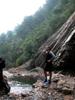
We meet and leave from HsinTian 新店 at 5:30AM. We drive to Dahsi 大溪 in Taoyuan 桃園, taking the 7 北橫 - North Cross island highway east to Baling 巴陵, arriving in Xuanyuan 萱源 by 7:00AM. The weather is clear and we have cloudless views of the Xueshan range 雪山山脈. We take a quick drive further along the 7 toward the trail down to Siling hot springs 四陵溫泉, but don't see any other trails that might bring us down closer to the waterfall.


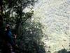
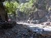
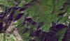
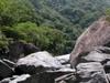
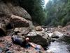
We start hiking down at 8:20. From an open area at the bend in the road near the 57.5k mark, a steep but easy trail heads down to the Sanguang river. About 5 mins in, a trail branches off to the right going westward towards the Hagawan suspension bridge 哈嗄彎吊橋. We take the left fork continuing southward, on the same trail that Bruce and Jack ran into bees on, on the way down, and then ants on the way back up, years ago. After another five minutes, we skirt a large landslide going all the way down to the river to the south. We get to the river at 8:55 and change into river gear and stow or dry hiking gear for the return. We start on our way upstream at 9:15.
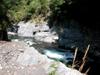
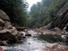
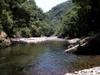
Jack tests the water in a narrows, bordered by a high shelf. 9:45.
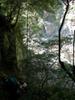
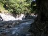
We arrive at a confluence with Galahe 嘎拉賀溪 stream from the south contributing roughly half the river volume at 10:30.
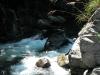
A disturbed stretch presents challenges. 11:30.
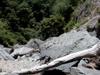
In some areas, the geology is so active, that the canyon face is raining light debris constantly.
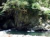
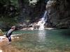
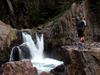
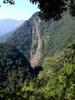
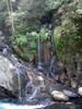
Another bend with pool and deep waterfall. 12:35. Though we are approaching our turn-around time and storm clouds are gathering, we decide to push on to find the giant waterfall after consulting our maps.
At 2:00 PM we arrive at the waterfall which has been reconfigured by geology. The giant pool has been filled in by a landslide and sharp rocks below the waterfall make jumping the waterfall questionable. This would still be a tricky point to hike through. We head back quickly as the thunderstorm approaches. It rains but no very hard. We are back at the bottom of the trail we came down at 5:45.
| 1 | 9:45 AM | 290114 | 2727187 | Starting point on river |
| 2 | 10:40 AM | 290514 | 2727015 | Confluence with stream towards Xinxing |
| 3 | 12:35 AM | 2918581 | 2725999 | Bend with pool and waterfall |
| 4 | 13:55 PM | 292748 | 2726525 | Giant waterfall |