

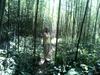
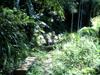
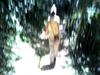
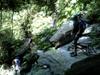
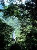
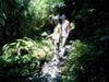
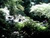
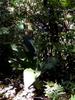
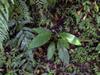
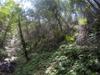
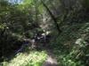
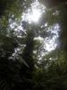


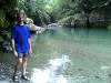

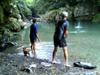
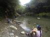
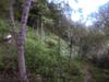
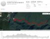
Mid-summer hike into the Kalamoji 卡拉莫基 trail (Hapen trail 哈盆越嶺步道) with Philip, Tammy, Bruce, Wendy and Poppy from 福山 Fushan at 400m. We turn around at the first stream crossing crowded with picnicers and go back to our usual swimming spot where there is only a small group of river tracers in training and they quickly continue down stream.
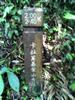
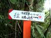
Kalamoji 卡拉莫基 (qlang krmut) is the name of the Atayal settlement at the head of the trail which leads to the former Hapen tribal area (舊哈盆部落). Kalamoji is one of the four Atayal settlements of Fushan 福山 (tanapavana): 屯鹿 (tunoq), 李茂岸 (李茂岸山, 福山), Kalamoji 卡拉模基 (qlang krmut), and 塔拉南. Hapen 哈盆 (gong hbybg) means the land between two converging streams.
Fushan village is located in the Hapen Nature Reserve 哈盆自然保留區 and the Takuanshan Forest Reserve 達觀山自然保護區. At the confluence of the Daluolan stream 大羅蘭溪, Zhakong stream 札孔溪 and Nanshih stream 南勢溪 and hosts the trailheads to Hapen trail 哈盆古道 or Kalamoji 卡拉莫基, FuBa trail (Fushan to Baling pass) 巴福越嶺 and the trail to North ChaTian Mountain 北插天山. The Atayal chieftain Yatai Bunadai 亞維.布納帶 founded the village Sha-ya-kong 札亞孔 in the late 18th century in this place where the fish of the steams where plentiful and the animals of the forest abundant. The Japanese colonists called the place a fortunate mountain 一座有福氣的山 for its rich camphor stands and the name was simplified to Fushan 福山.
Construction of the road from Guishan 龜山 to XinXian 信賢 began in 1928, with the primary segment being the rail line from Wulai 烏來 to XinXian 信賢. With the breakout of the second world war, exploitation of resources in the colonies accelerated and the Japanese extended logging operations to Fushan 福山. In 1943, construction of the rail segment from XinXian 信賢 to Fushan 福山 (李茂岸) began.
Provincial road 107 North was opened in 1975 connecting Wulai 烏來 to Xinxian 信賢 to Tunlu 屯鹿 to Xiapen 下盆 to Fushan 福山 over 18 kilometres to be FusHan's only connecting road to the outside world. The people of Wulai 烏來 are the Malepa 馬立巴系統 of the Seqoleq 賽考列克族 who are Atayal 泰雅族. They originally came from Renai 仁愛 township in Nantou 南投, immigrating northward as their population grew.