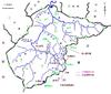
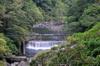
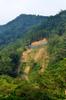
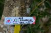
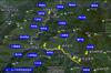
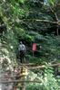
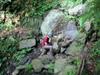
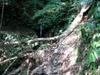
Philip and Dan leave Garden City in XinDian 新店 Wednesday at 2PM and drive south into the mountains past Wulai 烏來, an aboriginal village 15km south of Taipei. Our plan was to drive east from Wulai 烏來 to Xiaoyi 孝義 and then walk two hours south on the Xikeng trail 西坑林道 to the Shikeng bridge 獅坑橋 and camp there. When we got to the Xiaoyi 孝義 police checkpoint 烏玉檢查哨 (Wūyù jiǎncháshào) to enter the ChaTian Preserve 插天山自然保留區 (Chātiānshān zìrán bǎoliúqū), we learned that the road past the village of Xiaoyi 孝義 was closed due to a massive landslide, and the Xikeng trail 西坑林道 we wanted to hike in on was also closed due to a landslide. There was a new gate manned by police right at Xiaoyi village, so we could not get to the trail head. Heavy construction trucks were coming out of the Tongho road 桶后林道. So with only a few hours of daylight left to hike and pitch a camp, we decided to drive back to Wulai 烏來, go south to Fushan village 福山, and walk up the Fu-Ba trail 福巴越嶺步道 toward Lala Mt. 拉拉山.


This side trail goes down and crosses the Zhakong stream 札孔溪 leading back up to Zhakong mountain forest 札孔山森林 (100 mins) and 李茂岸山 (lǐ mào àn) mountain (180 mins).
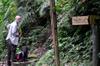
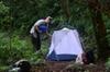
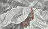
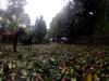
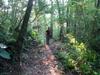
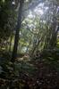
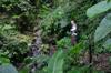
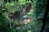
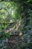
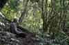
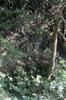
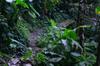
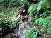
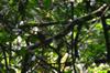
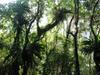
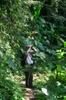
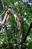
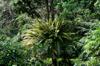
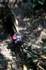
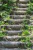
We walked in Fu-Ba trail 福巴越嶺步道 for about two hours, climbing from 400m at the trail head to about 750m in elevation, and pitched a tent in a broad flat part of the trail. The trail passes through virgin forest that changes from low-elevation to high-elevation vegetation as you ascend. We hiked under 4 km of total 17 km required to reach Lala Mt. 拉拉山. By the time we got the tent up it was almost dark. At dusk, we had hornets biting, attracted to our sweaty clothes, then a short period of mosquitoes for about 20 minutes as the evening darkened. We sat to eat our dinner outside the tent as a group of about 15 Formosan flying foxes (Ryukyu flying fox) 台灣狐蝠 Pteropus dasymallus formosus (huge bats) came flying down the trail, passing very close to our heads. We heard muntjacs calling several times during the night.
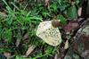
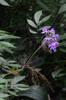
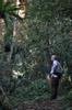
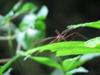
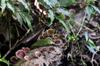
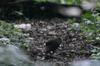
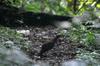
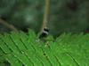
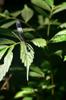
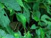
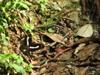
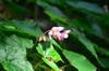
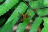
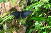
The next morning we walked a few kilometers further up the Fu-Ba trail 福巴越嶺步道 and heard several Reeves's muntjac (barking deer) 山羌 (shān qiāng) Muntiacus reevesi, Formosan rock macaques 台灣獼猴 (táiwān míhóu) Macaca cyclopis (saw one scrambling through the canopy), and many butterflies and birds, including a family of Swinhoe's Pheasant 藍腹鷳 (lán fù xián) Lophura swinhoii.


The Atayal arrived in the Fushan area over two centuries ago, travelling over the the mountains from Pinsban (旁斯博干) - current day Ruiyanfa village in Renai Township of Nantou County 南投縣仁愛鄉瑞岩發祥村, establishing three settlements in the Fushan area - Tranan (塔拉南)、Rimgoan (李茂岸), and Jiyacon (札亞孔). They later spread further north, establishing sites in 屈尺 and 乾溝. Kalamoji 卡拉莫基 (qlang krmut) is the name of the Atayal settlement at the head of the trail which leads to the former Hapen tribal area (舊哈盆部落). Kalamoji is one of the four Atayal settlements of Fushan 福山 (tanapavana): 屯鹿 (tunoq), 李茂岸 (李茂岸山, 福山), Kalamoji 卡拉模基 (qlang krmut), and 塔拉南. Hapen 哈盆 (gong hbybg) means the land between two converging streams.