Heping North Stream 和平北溪

journal > 2018 > Heping North Stream 和平北溪


Hualien/Yilan Heping North Stream, Hot Springs Survey Expedition
花蓮/宜蘭 和平北溪 溫泉調查
Leigh, Nick, Philip, Wolfgang
4/28 - 4/29, 2018

Heping North Stream 和平北溪 P_20180427_185429
Friday train to Xincheng 新城

Leave Taipei 台北 Friday evening by train to spend the night in Xincheng 新城 closer to the trail head.

Heping 和平 town on the east coast of Taiwan

Heping North Stream 和平北溪 P_20180428_080834
Leaving civilization in Heping 和平

Drive to Taiwan Power 台電's Bihai Power Plant 碧海發電廠

Heping North Stream 和平北溪 IMAG0280
beginning of the Heping forest road 和平林道 or Dazhuoshui forest road 大濁水林道
Heping North Stream 和平北溪 IMAG0287
to Taipower Bihai hydroelectric power plant 台電碧海發電廠
Heping North Stream 和平北溪 IMAG0301
the industrial town of Heping 和平
Heping North Stream 和平北溪 IMAG0289
Dazhuoshui river 大濁水溪
Heping North Stream 和平北溪 IMAG0290
Badagang tunnel 巴達崗隧道
Heping North Stream 和平北溪 Heping-to-Bihai
10.8 km drive from Heping 和平 village to Bihai Power Plant 碧海電廠

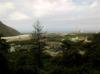
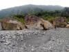
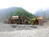
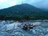
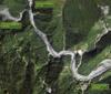
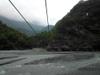
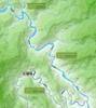
Saturday morning we drive in 14 km from Heping 和平 up the Heping forest road 和平林道 (or Dazhuoshui forest road 大濁水林道) along the south side of the Heping River 和平溪 (or Dazhuoshui river 大濁水溪) which marks the border between Hualien and Yilan 宜蘭 counties. Passing beyond all the cement quarrying industry of Taiwan Cement we arrive at the Dongbu Power Plant Bihai Branch 東部發電廠 碧海機組 where the road is blocked by a gate. An aborigine guard comes out to inform us that passage beyond the gate requires approval from the Taiwan Power office in Hualien 花蓮 despite the mountain entry permits 入山許可證 we hold issued by the county police authorities. The Nanxi Dam 南溪壩, another 10 odd kilometers further in on the Heping forest road, at an altitude of 545 meters, on the Heping South River 和平南溪 creates a reservoir with a capacity of 635,000 m3 supplying water to the turbines at Bihai after dropping 445 meters. Surveying for the dam began in 1996. Construction started in 2001 and the dam began operation in December of 2011 after project costs of NT$16.5 billion (US$ 569 million). An intake valve connects the dam at 545 meters altitude with a 6,549 meter long headrace tunnel to Bihai Power Plant at an altitude of 100 meters where a vertical Pelton turbine generates 61.2 MW of power. The plant generates 237 GWh annually. 18 hours of daily water capture and storage generate enough electricity to supply six hours of peak load in the region.

Bihai Power Plant 碧海電廠 to Heping North Stream 和平北溪

Heping North Stream 和平北溪 P_20180428_092740
Bihai 碧海 spillway below Heping forest road 和平林道
Heping North Stream 和平北溪 A55A0001
Heping North Stream 和平北溪 A55A0002
looking for a place to cross Heping River 和平溪
Heping North Stream 和平北溪 P4280003
failed attempt to cross Bihai 碧海 spillway
Heping North Stream 和平北溪 P4280004
Wolfgang trying to cross the river
Heping North Stream 和平北溪 P4280005
gravel works
Heping North Stream 和平北溪 A55A0004
harder to cross than it looks

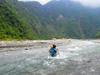
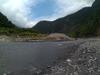
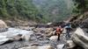
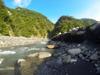
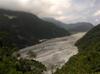
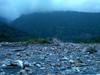
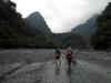
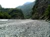
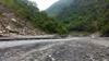
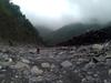
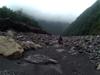
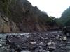
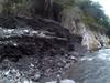
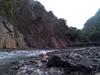
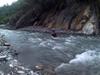
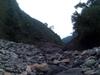
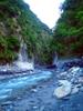
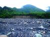
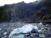
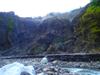
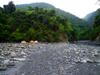
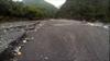
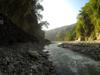
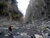
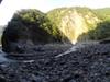
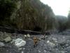
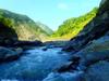
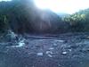
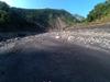
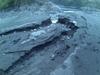
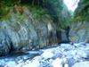
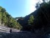
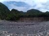
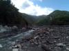
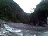
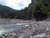
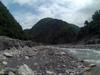
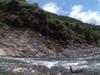
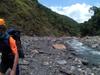
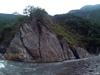
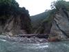
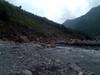
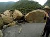
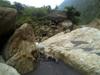
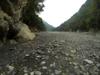
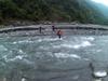
We turn around and drive almost a kilometer back down the valley where we can drive down to the river and drive back up the sandy packed truck track along the river bank almost back up to the level of the power plant again. Packing up to hike we quickly discover that the river is impossible to cross here and we hike back downstream well below our parking spot before we find a place where we can cross to the north side of the Heping River 和平溪. We find a gravel industry road on the north bank that cuts off a little over a kilometer of tracing along the river. We have lost hours of daylight to negotiating the beginning of the hike.

Heping forest road 和平林道

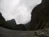
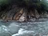
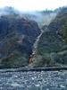
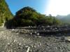
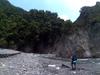
Various records of the road indicate that the road went on for 50 to 60 kilometers following along south of Heping South Stream 和平南溪. Some records suggest military function. There are also records of aborigine settlements which don't seem to exist anymore. The Nanxi Dam 南溪壩 was built in a remote area and most of the material and construction material was brought to the site with helicopters. Dam construction required the building out of 28 kilometers of road, 13 tunnels and 15 bridges. Excavation was limited to protect the integrity of the landscape. Though we were not permitted to enter the road, we clearly see the road in the contour of the mountain slopes south of us until we leave the south branch of the river to trace Heping North Stream 和平北溪.

to Heping North Stream 和平北溪

Heping North Stream 和平北溪 P_20180428_105647
abandoned machines
Heping North Stream 和平北溪 P_20180428_105650
road and power tranmission towers in the distance
Heping North Stream 和平北溪 P_20180428_110234
border of Hualien 花蓮 and Yilan 宜蘭 counties
Heping North Stream 和平北溪 P4280009
dog ?
Heping North Stream 和平北溪 ISAW0046
Heping North Stream 和平北溪 DSC00089
Barking deer 台灣山羌 (táiwān shān qiāng) Formosan Reeve's Muntjac prints
Heping North Stream 和平北溪 DSC00090
Heping river 和平溪 bed
Heping North Stream 和平北溪 P_20180428_115953
Heping river 和平溪
Heping North Stream 和平北溪 ISAW0049
network of roots
Heping North Stream 和平北溪 Bihai-to-Heping-confluence
4 km walk from Bihai Power Plant 碧海電廠 to Heping North Stream 和平北溪

Confluence of Heping South Stream 和平南溪 and Heping North Stream 和平北溪

Heping North Stream 和平北溪 P4280015
mouth of Heping North stream 和平北溪
Heping North Stream 和平北溪 P_20180428_120508
toward the confluence
Heping North Stream 和平北溪 DSC00091
mouth of Heping North stream 和平北溪
Heping North Stream 和平北溪 P4280017
Taipower facilities?
Heping North Stream 和平北溪 ISAW0050
wasp nest
Heping North Stream 和平北溪 ISAW0052
wasp nest close up
Heping North Stream 和平北溪 P_20180428_121100
Taipower cables over river
Heping North Stream 和平北溪 P4280018
Taipower facilities
Heping North Stream 和平北溪 P4280020
like ants in a field of stones
Heping North Stream 和平北溪 P_20180428_121143
Taipower cables over river
Heping North Stream 和平北溪 ISAW0053
Heping North Stream 和平北溪
Heping North Stream 和平北溪 ISAW0054

Hydrology of Taiwan

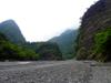
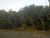
Taiwan is a 36,000 square kilometer subtropical island. Steep mountains over 1,000 meters in elevation cover 32% of the island; hills and terraces between 100 meters and 1,000 meters make up 31%; while alluvial plains below 100 meters, where most human activity is concentrated, cover the remaining 37%. The northeast monsoon prevails from October through March. Typhoons and thunderstorms bring in abundant rainfall from May through September. The mountains are dominated by fractured, and deeply weathered metamorphic and sedimentary rock. Intense rainfall and flow of flood water causes severe erosion which is compounded by earthquakes which undermine the stability of the slopes. The rivers of the island are short and steep, becoming torrential during heavy storms. About 78 % of annual precipitation falls from May through October, with most water delivered by storms and typhoons. Average annual rainfall is 2,515 millimeters or 90.5 billion cubic meters. Average annual runoff is 66.8 billion cubic meters, of which only 23 % or about 15.4 billion cubic meters, are available for the use during the dry period from October through April. Annual pumped groundwater is estimated at 7.1 billion cubic meters.

Heping North Stream 和平北溪 P_20180428_122533
lunch break at the confluence
Heping North Stream 和平北溪 20180428_125407
Heping streams 和平溪 confluence
Heping North Stream 和平北溪 20180428_125415
Heping North Stream 和平北溪 river bed

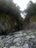
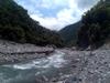
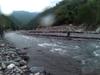
We arrive at the Heping North Stream 和平北溪 confluence at noon and are off again after a lunch break at 1 PM.

Heping watershed 和平流域

Heping North Stream 和平北溪 heping_watershed
Heping watershed 和平流域

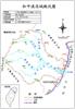
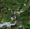
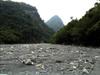
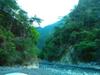
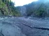
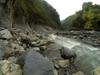
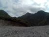
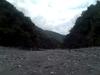
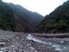
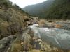
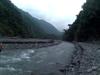
The Heping North river 和平北溪, Heping South river 和平南溪 Feng stream 楓溪 combined drain a 561 km2 watershed through the 48.2 km long river system originating from headwaters at Nanhuda mountain 南湖大山 at an elevation of 3,740 m in the central mountain range 中央山脈 flowing across Nanao township of Yilan county 宜蘭縣南澳鄉 and Xiulin township of Hualien counties 花蓮縣秀林鄉 before disgorging into the Pacific ocean on the island's east coast.

Heping North Stream 和平北溪 P_20180428_130016_HDR
Heping North Stream 和平北溪
Heping North Stream 和平北溪 20180428_131106
Heping North Stream 和平北溪 river bed
Heping North Stream 和平北溪 20180428_131458
Nick and Wolfgang
Heping North Stream 和平北溪 P_20180428_132053
sediment walls
Heping North Stream 和平北溪 P_20180428_132103
changing footwear
Heping North Stream 和平北溪 20180428_132623
Heping North Stream 和平北溪
Heping North Stream 和平北溪 20180428_133433
a wasp nest

Heping North Stream 和平北溪

Heping North Stream 和平北溪 P4280025
Heping North Stream 和平北溪 20180428_135201
stones swept around
Heping North Stream 和平北溪 20180428_135324
Heping North Stream 和平北溪 ISAW0057
walking among stones
Heping North Stream 和平北溪 20180428_141236
Heping North Stream 和平北溪
Heping North Stream 和平北溪 20180428_141450
Heping North Stream 和平北溪 20180428_141620
a side valley
Heping North Stream 和平北溪 P4280028
colored rock

Water Data

We tracked corresponding river height and rainfall at Bihai to gauge the possibility and safety of getting through the canyons into the upper reaches of Heping North stream 和平北溪. The Heping river system 和平溪水系 is administered by the First River Management Office 第一河川局 of the Water Resources Agency 水利署 under the Ministry of Economic Affairs 經濟部. The bureau operates Xinengbu 希能埔 river water level measuring station in Heping Village 和平村. Rainfall is measured at Taiwan Power Corporation Dongbu Power Plant Bihai Branch 秀林鄉臺電公司東部發電廠碧海機組廠. The CWB also maintains a comprehensive library of annual almanacs of the rainfall, flow and silting of all of the islands watersheds

Heping North Stream 和平北溪 20180428_144529
Heping North Stream 和平北溪
Heping North Stream 和平北溪 20180428_144550
Leigh crossing
Heping North Stream 和平北溪 A55A0008
Tall walls of sediment
Heping North Stream 和平北溪 A55A0010
Heping North Stream 和平北溪
Heping North Stream 和平北溪 A55A0013
Heping North Stream 和平北溪
Heping North Stream 和平北溪 A55A0015
resting
Heping North Stream 和平北溪 A55A0016
Heping North Stream 和平北溪 A55A0019
Heping North Stream 和平北溪 A55A0021
walls of sediment
Heping North Stream 和平北溪 A55A0022
Heping North Stream 和平北溪 A55A0024
many stream crossings
Heping North Stream 和平北溪 A55A0025
Heping North Stream 和平北溪 P4280029
many stream crossings
Heping North Stream 和平北溪 P4280031
some crossings are challenging
Heping North Stream 和平北溪 A55A0034
stream crossing
Heping North Stream 和平北溪 P4280030_854x480
Difficult river crossings
Heping North Stream 和平北溪 A55A0038
Heping North Stream 和平北溪 A55A0039
Heping North Stream 和平北溪 A55A0040
Heping North Stream 和平北溪 ISAW0060
Heping North Stream 和平北溪 A55A0042
stream crossing

Buxiaowan stream 布蕭丸溪 camp

Heping North Stream 和平北溪 P4280033
view from the mouth of Buxiaowan stream 布蕭丸溪
Heping North Stream 和平北溪 8868804451_strava_1525217389795_960x540
Heping North Stream 和平北溪 Heping-confluence-to-Buxiaowan-stream
20 km walk from Heping River 和平溪 to Buxiaowan stream 布蕭丸溪
Heping North Stream 和平北溪 P4280034
evening campfire

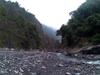
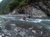
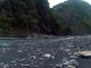
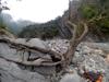
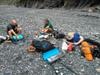
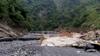
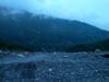
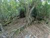
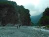
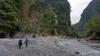
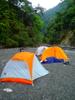
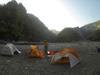
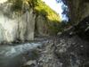
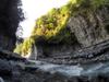
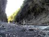
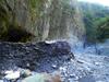
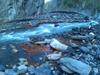
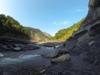
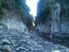
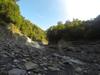
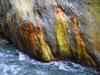
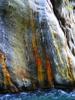
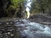
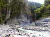
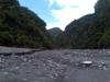
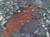
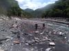
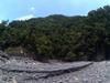
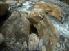
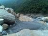
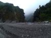
After a 5 hour, 20 km trace from the Heping river confluence, with many challenging crossings we arrive at our base camp destination at Buxiaowan stream 布蕭丸溪 just at nightfall. Our overall elevation climb today is from 100 m to 350 m. Our camp site is on high bluffs of sediment pushed up in recent storm drainage where the Buxiaowan stream 布蕭丸溪 flows into Heping North Stream 和平北溪 in the northeast corner of a vast washed out bend in the main river. Our original itinerary had us dropping or full packs here and tracing up the Buxiaowan stream 布蕭丸溪 another 2.3 km in the late afternoon with light packs north to the confluence with Liuxing stream 流興溪 where Buxiaowan hot springs 布蕭丸 was last reported. But we are too late for that. We look around our camp for signs of Dazhuoshui 大濁水 hot springs, but the whole landscape has been drastically resculpted by recent storms.

4/29 - Buxiaowan 布蕭丸 camp

Heping North Stream 和平北溪 P4290037
Buxiaowan stream 布蕭丸溪 behind our camp
Heping North Stream 和平北溪 P4290039
view upstream
Heping North Stream 和平北溪 buxiaowan-camp-satellite
Satellite view of Buxiaowan camp location
Heping North Stream 和平北溪 P4290041
view upstream
Heping North Stream 和平北溪 GOPR2766
Buxiaowan 布蕭丸 camp
Heping North Stream 和平北溪 P4290043
Heping North Stream 和平北溪 P4290044
eroded walls of silt
Heping North Stream 和平北溪 P4290046
landslide opposite camp
Heping North Stream 和平北溪 P4290047
landslide opposite camp
Heping North Stream 和平北溪 P4290048
huge landslide opposite our camp at Buxiaowan stream 布蕭丸溪
Heping North Stream 和平北溪 P4290050
camp and Buxiaowan stream 布蕭丸溪
Heping North Stream 和平北溪 P4290051
camp and Buxiaowan stream 布蕭丸溪
Heping North Stream 和平北溪 P_20180429_062345_HDR
landslide viewed from our camp at Buxiaowan stream 布蕭丸溪
Heping North Stream 和平北溪 P_20180429_062351_HDR
downstream Heping North stream 和平北溪 from our camp
Heping North Stream 和平北溪 P_20180429_062504
trees behind our camp
Heping North Stream 和平北溪 GOPR2768_854x480
camp site in the distance
Heping North Stream 和平北溪 P_20180429_063344
Buxiaowan stream 布蕭丸溪
Heping North Stream 和平北溪 P_20180429_063402
quick breakfast
Heping North Stream 和平北溪 GOPR2769
Buxiaowan 布蕭丸 camp

Hot Springs in the upper reaches of Heping North stream 和平北溪

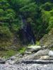
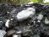
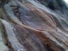
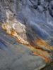
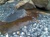
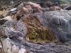
There are several records of natural wild hot springs on branches of Heping North stream 和平北溪. The information from different sources is inconsistent, including naming. Storms may have covered springs or revealed new ones. So a survey is required.

Heping North Stream 和平北溪 heping-hot-springs-marked
Heping North Stream 和平北溪 hot springs

Continuing up Heping North Stream 和平北溪

Heping North Stream 和平北溪 GOPR2771
continuing north along Heping North stream 和平北溪

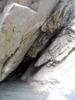
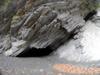
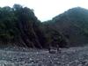
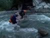
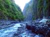
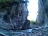
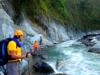
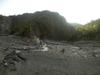
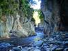
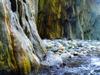
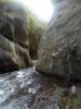
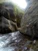
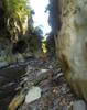
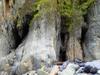
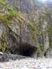
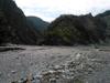
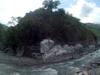
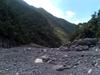
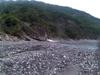
With limited time, we decide that Mohen stream 莫很溪 is the more interesting option to explore. We leave our camp with light packs at 7 AM deciding that we need to be back by 11 AM in order to be able to get back out to Heping before dark. Leaving the vast wash in the bend of the river at our camp at Buxiaowan 布蕭丸, the stream passes through a short slot where we visit a little bat cave before the river bed opens again into another vast wash of sediment banks at the Mohen stream 莫很溪 confluence.

Heping North Stream 和平北溪 GOPR2773
leaving the Buxiaowan 布蕭丸 alluvial plain
Heping North Stream 和平北溪 GOPR2774
Buxiaowan 布蕭丸 alluvial accumulation
Heping North Stream 和平北溪 GOPR2775
leaving the Buxiaowan 布蕭丸 alluvial plain

Slot and bat cave on the way to the Mohen stream confluence

Heping North Stream 和平北溪 GOPR2776
looking back toward the confluence
Heping North Stream 和平北溪 GOPR2777
continuing up Heping North Stream 和平北溪
Heping North Stream 和平北溪 ISAW0063
Heping North Stream 和平北溪 slot canyon
Heping North Stream 和平北溪 ISAW0065
looking back downstream
Heping North Stream 和平北溪 ISAW0066
to the cave
Heping North Stream 和平北溪 ISAW0067
looking downstream
Heping North Stream 和平北溪 P4290052
entering the bat cave
Heping North Stream 和平北溪 P4290053
guano
Heping North Stream 和平北溪 A55A0046
approaching the cave
Heping North Stream 和平北溪 P4290055
view from inside the cave
Heping North Stream 和平北溪 ISAW0069
view downstream from the cave entrance
Heping North Stream 和平北溪 P4290057
miniature hoodoos
Heping North Stream 和平北溪 ISAW0070
view from the cave silt wall
Heping North Stream 和平北溪 ISAW0073
Heping North Stream 和平北溪 P4290059
silt in front of the cave and slot downstream
Heping North Stream 和平北溪 A55A0049
miniature hoodoos
Heping North Stream 和平北溪 GOPR2780
silt wall at the cave entrance
Heping North Stream 和平北溪 P4290062
the slot canyon broadens
Heping North Stream 和平北溪 GOPR2782
Heping North Stream 和平北溪 A55A0050
exiting the slot canyon
Heping North Stream 和平北溪 P4290064
tough crossings coming out of the slot canyon
Heping North Stream 和平北溪 P4290065
exiting the slot
Heping North Stream 和平北溪 GOPR2783
approaching the Mohen confluence

Mohen stream 莫很溪 confluence

Heping North Stream 和平北溪 GOPR2784
Mohen stream 莫很溪 confluence
Heping North Stream 和平北溪 P4290069
Mohen stream 莫很溪 confluence
Heping North Stream 和平北溪 A55A0056
looking downstream from the confluence
Heping North Stream 和平北溪 A55A0057
looking downstream toward the confluence
Heping North Stream 和平北溪 ISAW0076
Mohen stream 莫很溪 confluence
Heping North Stream 和平北溪 GOPR2786
broad wash westward of Heping north stream from the confluence
Heping North Stream 和平北溪 A55A0058
walls of fine sediment
Heping North Stream 和平北溪 A55A0059
continuing up Mohen stream 莫很溪

First Mohen stream 莫很溪 slot canyon

Heping North Stream 和平北溪 P4290073
entering first Mohen stream 莫很溪 canyon slot
Heping North Stream 和平北溪 ISAW0077
Heping North Stream 和平北溪 A55A0061
first Mohen stream 莫很溪 canyon slot
Heping North Stream 和平北溪 P4290074
first Mohen stream 莫很溪 canyon slot
Heping North Stream 和平北溪 GOPR2787
first Mohen stream 莫很溪 canyon
Heping North Stream 和平北溪 A55A0064
first Mohen stream 莫很溪 canyon
Heping North Stream 和平北溪 P4290075
first Mohen stream 莫很溪 canyon
Heping North Stream 和平北溪 P4290076
OLYMPUS DIGITAL CAMERA
Heping North Stream 和平北溪 GOPR2788
first Mohen stream 莫很溪 canyon slot
Heping North Stream 和平北溪 GOPR2789
the slot broadens
Heping North Stream 和平北溪 P4290083
looking back to Mohen stream 莫很溪 canyon slot
Heping North Stream 和平北溪 A55A0068
distant landslide on Mohen stream as we turn around

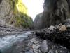
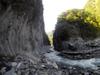
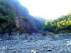
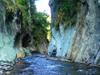
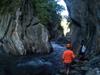
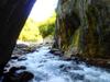
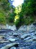
We turn around in sight of a landslide upstream on Mohen stream 莫很溪 which looks to be the beginning of a second slot canyon. Returning at 8:30 will allow us enough time to get back to our camp and walk out back out to Heping by the end of the day. We saw flags in the direction of the Mohen peninsula walk over by Nick was unable to follow the trail.

Return to base camp at Buxiaowan 布蕭丸

Heping North Stream 和平北溪 P4290084
Heping North Stream 和平北溪 P4290085
Heping North Stream 和平北溪 P4290087
Heping North Stream 和平北溪 GOPR2790
Mohen slot canyon
Heping North Stream 和平北溪 GOPR2791
Heping North Stream 和平北溪 GOPR2792
Mohen slot canyon
Heping North Stream 和平北溪 P4290089
Heping North Stream 和平北溪 GOPR2793
Heping North Stream 和平北溪 P4290091
Heping North Stream 和平北溪 GOPR2794
Heping North Stream 和平北溪 P4290094
Heping North Stream 和平北溪 P4290095
Heping North Stream 和平北溪 P4290096
water leaves its mark
Heping North Stream 和平北溪 A55A0071
Heping North Stream 和平北溪 P4290098
back to the cave
Heping North Stream 和平北溪 P4290099
bat cave at entrance of Heping north slot
Heping North Stream 和平北溪 GOPR2795
at the bat cave
Heping North Stream 和平北溪 GOPR2798
Leigh at the bat cave
Heping North Stream 和平北溪 P4290100
mineral brushstrokes
Heping North Stream 和平北溪 A55A0072
Heping North Stream 和平北溪 A55A0073
Buxiaowan 布蕭丸 confluence
Heping North Stream 和平北溪 P_20180429_095254
Buxiaowan 布蕭丸 confluence

We pack up for the hike out.

Heping North Stream 和平北溪 A55A0077
Heping North Stream 和平北溪 A55A0078
Heping North Stream 和平北溪 A55A0079
Heping North Stream 和平北溪 A55A0082
Heping North Stream 和平北溪 A55A0084
Heping North Stream 和平北溪 A55A0085
Heping North Stream 和平北溪 A55A0088
Heping North Stream 和平北溪 A55A0089
Heping North Stream 和平北溪
Heping North Stream 和平北溪 A55A0090
Heping North Stream 和平北溪
Heping North Stream 和平北溪 A55A0092
Heping North Stream 和平北溪 A55A0093
Heping North Stream 和平北溪 A55A0095
Heping North Stream 和平北溪
Heping North Stream 和平北溪 A55A0096
Heping North Stream 和平北溪
Heping North Stream 和平北溪 A55A0099
Heping North Stream 和平北溪
Heping North Stream 和平北溪 A55A0102
Heping North Stream 和平北溪 A55A0103
Heping North Stream 和平北溪 A55A0104
Heping North Stream 和平北溪 A55A0106
Heping North Stream 和平北溪 A55A0107
Heping North Stream 和平北溪 A55A0111
Heping North Stream 和平北溪 A55A0119
Heping North Stream 和平北溪 A55A0121
Heping North Stream 和平北溪 A55A0122
Heping North Stream 和平北溪 A55A0124
Heping North Stream 和平北溪 GOPR2802
Heping North Stream 和平北溪 GOPR2803
Heping North Stream 和平北溪 GOPR2804
Heping North Stream 和平北溪 A55A0125
Heping North Stream 和平北溪 A55A0128
Heping North Stream 和平北溪 GOPR2805
Nick
Heping North Stream 和平北溪 GOPR2807
Heping North Stream 和平北溪 GOPR2809
Heping North Stream 和平北溪 GOPR2810
Heping North Stream 和平北溪 river bed
Heping North Stream 和平北溪 A55A0129
Heping North Stream 和平北溪 A55A0130
Heping North Stream 和平北溪 A55A0135
Heping North Stream 和平北溪 A55A0142
Bihai 碧海 spillway
Heping North Stream 和平北溪 P_20180429_183518
Heping

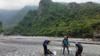
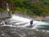
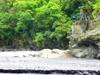
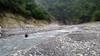
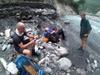
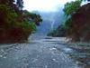
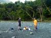
As we take our final rest back at the confluence with Heping south stream we see the first other people we have seen on our trip far on the opposite bank of the river. They are traveling downstream parallel to us with a dog. One of them crosses to speak with us and asks not to take any photos of them. We notice that they are floating a large log downstream. The urge us to hurry to get down and across before the spillway releases. We continue travelling downstream parallel to them watching them float their giant log. As we approach our parked car we notice that a blue truck has come down to meet the men in the evening dusk to collect the log.

Keywords: animal, building, canyon, cave, forest, geology, hike, hot springs, insect, landslide, map, river, road, rock, sign, stream, train, tree, tunnel, video, water
People: Leigh, Nick, Philip, Wolfgang
Locations: Dadaocheng, 大稻埕, Heping, 和平
Dates: 2018:04:27 - 2018:04:29